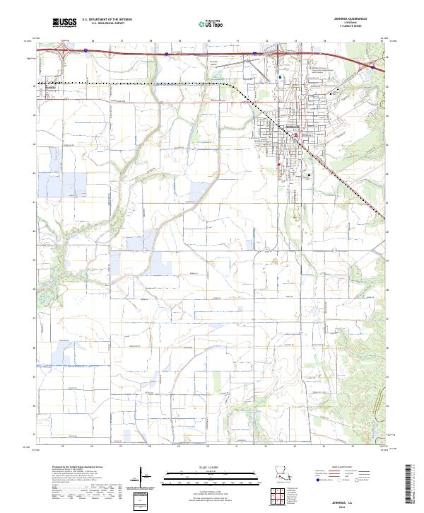
2024 Map of Jennings
USGS Topo · Published 2024About this map
The Jennings townsite and its surrounding agricultural plains in Jefferson Davis Parish are characterized by a sophisticated network of water management features, including the Jennings-Norwood Canal and Broadmore Ditch. This landscape, where the prairie meets the drainage basins of West Bayou Grand Marais and Middle Bayou Grand Marais, reflects a history of rice cultivation and water control. The town center is well-defined by a dense grid of streets such as Shankland Ave and W Plaquemine St, while institutional anchors like the SOWELA Technical Community College Morgan Smith Campus and Jennings Airport mark the community's modern footprint.
Find a feature on this map
82 named features on this map. Tap any name to fly to it.
Don’t see what you’re looking for? This feature index may not catch every label — zoom into the map to look around manually.
Map Details
Editions of this 2024 Jennings Map
This is the sole edition of this map. No revisions or reprints were ever made.
Other maps of this area

1946 · Lake Arthur
USGS Topo · 1:31,680

1946 · Mermentau
USGS Topo · 1:31,680

1946 · Jennings
USGS Topo · 1:31,680

1947 · Evangeline
USGS Topo · 1:31,680

1947 · Thornwell
USGS Topo · 1:31,680

1947 · Pine Island
USGS Topo · 1:31,680

1947 · Welsh
USGS Topo · 1:31,680

1947 · Hathaway
USGS Topo · 1:31,680

1949 · Gueydan
USGS Topo · 1:31,680

1952 · Lake Charles
USGS Topo · 1:250,000