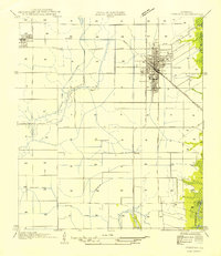
1954 Map of Jennings
USGS Topo · Published 1954About this map
Jennings serves as the central hub of this agricultural landscape in Jefferson Davis Parish, its dense street grid defined by the Southern Pacific railroad and the State Highway No 90 corridor. To the west, the smaller settlement of Roanoke sits along the same rail line, surrounded by a complex system of irrigation infrastructure essential for rice farming. The map details an intricate network of man-made waterways like Sturdivant Canal and various unnamed ditches that cut across the prairie to manage the local water supply. Natural drainage is provided by the winding Grand Marais and the Bayou Nezpique, which flows into the Mermentau River at the southeastern edge of the survey. Significant rural landmarks such as Keystone and Broadmore highlight the early 20th-century development of this coastal prairie region.
Find a feature on this map
24 named features on this map. Tap any name to fly to it.
Don’t see what you’re looking for? This feature index may not catch every label — zoom into the map to look around manually.
Map Details
Editions of this 1954 Jennings Map
This is the sole edition of this map. No revisions or reprints were ever made.
Other maps of this area

1946 · Lake Arthur
USGS Topo · 1:31,680

1946 · Mermentau
USGS Topo · 1:31,680

1946 · Jennings
USGS Topo · 1:31,680

1947 · Evangeline
USGS Topo · 1:31,680

1947 · Thornwell
USGS Topo · 1:31,680

1947 · Pine Island
USGS Topo · 1:31,680

1947 · Welsh
USGS Topo · 1:31,680

1947 · Hathaway
USGS Topo · 1:31,680

1949 · Gueydan
USGS Topo · 1:31,680

1952 · Lake Charles
USGS Topo · 1:250,000