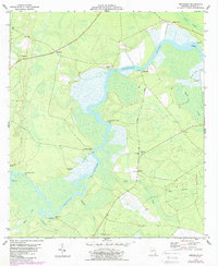
1978 Map of Jerusalem
USGS Topo · Published 1987About this map
The Satilla River dictates the settlement pattern and industrial geography of this coastal Georgia landscape, winding through a complex network of marshes and swamp. In the late 1970s and early 1980s, the river remained a vital cultural corridor, marked by landings and family-named landmarks like Clarks Bluff and Bullhead Bluff. Notable for genealogists, the map identifies small rural clusters and mill sites such as John Baileys Mill and Jim Baileys Mill, alongside community centers like Jerusalem and Tompkins. The presence of a Claypit near the National Highway suggests the localized extraction industries that persisted alongside traditional river-based livelihoods. Interior settlements like Scarlet and Wilkerson are connected by the transition from the Old Highway to modern routes, while the shoreline is dotted with distinctive nautical hazards and landmarks including Hells Gate and Monkey Island.
Find a feature on this map
39 named features on this map. Tap any name to fly to it.
Don’t see what you’re looking for? This feature index may not catch every label — zoom into the map to look around manually.
Map Details
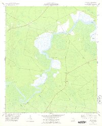
Editions of this 1978 Jerusalem Map
2 editions found
Other maps of this area

1917 · Nahunta
USGS Topo · 1:62,500

1917 · Boulogne
USGS Topo · 1:62,500

1918 · Nahunta
USGS Topo · 1:62,500

1918 · Bladen
USGS Topo · 1:62,500

1918 · Kingsland
USGS Topo · 1:62,500

1919 · Boulogne
USGS Topo · 1:62,500

1939 · Bladen
USGS Topo · 1:62,500

1946 · Brunswick
USGS Topo · 1:250,000

1948 · Jacksonville
USGS Topo · 1:250,000

1948 · Brunswick
USGS Topo · 1:250,000