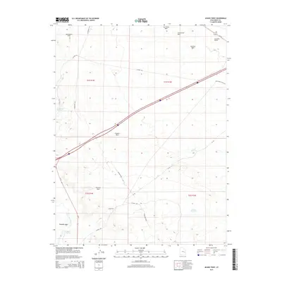
2014 Map of Jessies Twist
USGS Topo · Published 2014About this map
Jessies Twist anchors this high-desert landscape in the modern era, where a network of seasonal washes and man-made water storage systems defines the local topography. The map details a transition from the broad Gunnison Valley in the northeast toward the distinctive Shadscale Mesa and the winding course of the San Rafael River in the southwest. Transport through this arid stretch of Emery County is dominated by the corridor of Old Highway Hanksville and a series of rural routes like Buckmaster Rd and Co Road 1029.
Find a feature on this map
25 named features on this map. Tap any name to fly to it.
Don’t see what you’re looking for? This feature index may not catch every label — zoom into the map to look around manually.
Map Details
Editions of this 2014 Jessies Twist Map
This is the sole edition of this map. No revisions or reprints were ever made.
Other maps of this area

1885 · San Rafael
USGS Topo · 1:250,000

1886 · Price River
USGS Topo · 1:250,000

1896 · Price River
USGS Topo · 1:250,000

1953 · Tidwell 2 SW
USGS Topo · 1:24,000

1953 · Beckwith Peak SW
USGS Topo · 1:24,000

1953 · Tidwell 2 NW
USGS Topo · 1:24,000

1954 · Tidwell 1 SW
USGS Topo · 1:24,000

1954 · Tidwell 2 SE
USGS Topo · 1:24,000

1954 · Tidwell 2 NE
USGS Topo · 1:24,000

1954 · Tidwell 1 NW
USGS Topo · 1:24,000