2022 Map of Jetmore
USGS Topo · Published 2022About this map
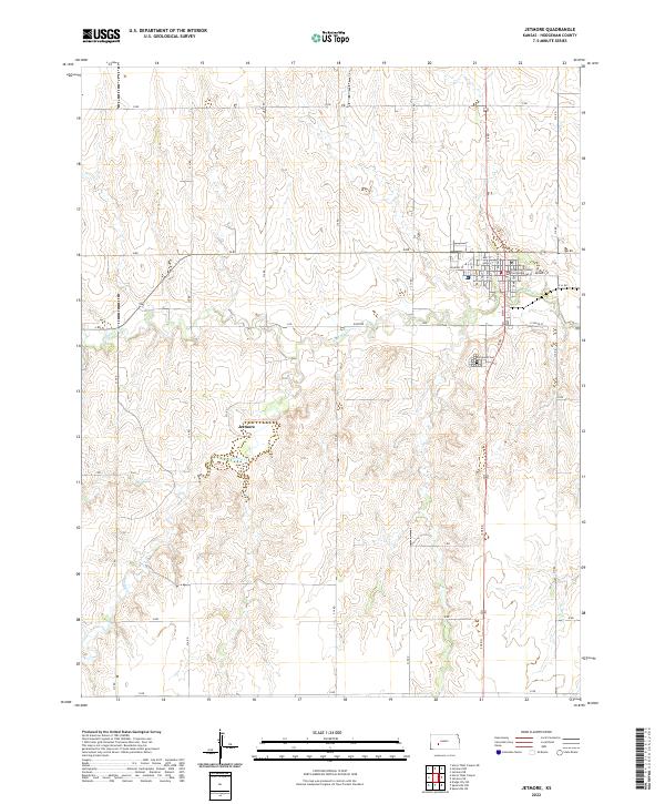
Jetmore serves as the focal point of this Hodgeman County landscape, where the street grid of the county seat meets the open plains of western Kansas. The Hodgeman County Courthouse stands as a central landmark within the town, surrounded by local thoroughfares like Highway St and Best St. To the south, the Fairmount Cem provides a point of genealogical interest near the junction of local transit routes.
Find a feature on this map
25 named features on this map. Tap any name to fly to it.
Don’t see what you’re looking for? This feature index may not catch every label — zoom into the map to look around manually.
Map Details
Editions of this 2022 Jetmore Map
This is the sole edition of this map. No revisions or reprints were ever made.
Other maps of this area

1892 · Ness
USGS Topo · 1:125,000

1892 · Dodge
USGS Topo · 1:125,000

1892 · Spearville
USGS Topo · 1:125,000

1894 · Spearville
USGS Topo · 1:125,000

1894 · Ness
USGS Topo · 1:125,000

1955 · Great Bend
USGS Topo · 1:250,000

1955 · Pratt
USGS Topo · 1:250,000

1955 · Dodge City
USGS Topo · 1:250,000

1955 · Scott City
USGS Topo · 1:250,000

1957 · Great Bend
USGS Topo · 1:250,000