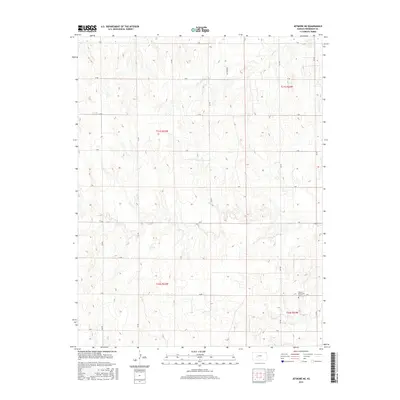
2015 Map of Jetmore NE
USGS Topo · Published 2015About this map
Hanston Mennonite Church stands as the primary community landmark in this rural section of Hodgeman County, situated in the southeastern corner of the map. The landscape is defined by the ephemeral drainage patterns of the High Plains, notably Sand Cr and Dry Cr, which cut through the open terrain. The mapping reveals a strictly organized section-line road network, including corridors such as S Rd and 225 Rd, that dictates the movement of people and commerce across the agricultural reaches of Kansas. A lone Oil Field Rd in the north suggests the localized presence of energy extraction, contrasting with the surrounding township-and-range divisions. This 2015 survey reflects the enduring spatial layout of the western Kansas wheat belt, where isolated religious centers and grid-based infrastructure remain the anchors of rural life.
Find a feature on this map
23 named features on this map. Tap any name to fly to it.
Don’t see what you’re looking for? This feature index may not catch every label — zoom into the map to look around manually.
Map Details
Editions of this 2015 Jetmore NE Map
This is the sole edition of this map. No revisions or reprints were ever made.
Other maps of this area

1892 · Ness
USGS Topo · 1:125,000

1894 · Ness
USGS Topo · 1:125,000

1955 · Great Bend
USGS Topo · 1:250,000

1957 · Great Bend
USGS Topo · 1:250,000

1958 · Great Bend
USGS Topo · 1:250,000

1969 · Jetmore
USGS Topo · 1:24,000

1970 · Jetmore SE
USGS Topo · 1:24,000
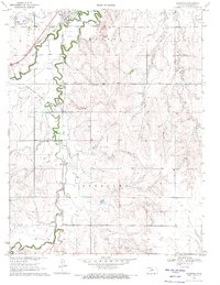
1970 · Hanston
USGS Topo · 1:24,000

1970 · Hanston NW
USGS Topo · 1:24,000

1970 · Jetmore NE
USGS Topo · 1:24,000