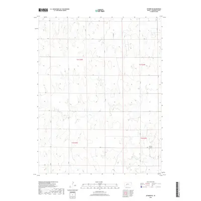
2018 Map of Jetmore NE
USGS Topo · Published 2018About this map
Hanston Mennonite Church sits in the southeastern portion of this Hodgeman County landscape, representing a quiet pocket of community life in a region defined by its rigid grid of section roads. The terrain is marked by the branching drainages of Sand Cr and Dry Cr, which cut through the high plains. The transition from agricultural use to energy extraction is hinted at by the presence of Oil Field Rd, which services the industrial infrastructure interspersed among the farms. Surveyed in the late 2010s, this area reflects the persistent geometry of the Public Land Survey System, with boundaries like t21s r23w and t22s r22w anchoring the rural township organization that has shaped western Kansas for generations.
Find a feature on this map
22 named features on this map. Tap any name to fly to it.
Don’t see what you’re looking for? This feature index may not catch every label — zoom into the map to look around manually.
Map Details
Editions of this 2018 Jetmore NE Map
This is the sole edition of this map. No revisions or reprints were ever made.
Other maps of this area

1892 · Ness
USGS Topo · 1:125,000

1894 · Ness
USGS Topo · 1:125,000

1955 · Great Bend
USGS Topo · 1:250,000

1957 · Great Bend
USGS Topo · 1:250,000

1958 · Great Bend
USGS Topo · 1:250,000

1969 · Jetmore
USGS Topo · 1:24,000

1970 · Jetmore SE
USGS Topo · 1:24,000
1970 · Hanston
USGS Topo · 1:24,000

1970 · Hanston NW
USGS Topo · 1:24,000

1970 · Jetmore NE
USGS Topo · 1:24,000