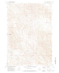
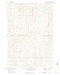
1972 Map of Jewell Draw
USGS Topo · Published 1975About this map
The boundary between Sheridan and Johnson counties divides this high plains landscape, surveyed in the early 1970s as part of a Department of the Interior program for the Missouri River Basin. The terrain is defined by an intricate network of ephemeral watercourses including Jewell Draw, Keathley Draw, and Headgate Draw, which cut through the ridges toward North Prong Cottonwood Creek and South Prong Cottonwood Creek. These drainage patterns are characteristic of the region's semi-arid rangeland, where water management is critical for local livestock and land use.
Find a feature on this map
12 named features on this map. Tap any name to fly to it.
Don’t see what you’re looking for? This feature index may not catch every label — zoom into the map to look around manually.
Map Details
Editions of this 1972 Jewell Draw Map
This is the sole edition of this map. No revisions or reprints were ever made.
Other maps of this area

1955 · Sheridan
USGS Topo · 1:250,000

1958 · Sheridan
USGS Topo · 1:250,000

1962 · Sheridan
USGS Topo · 1:250,000

1971 · Arvada
USGS Topo · 1:24,000

1971 · Leiter
USGS Topo · 1:24,000
1971 · Arvada NE
USGS Topo · 1:24,000

1972 · Mitchell Draw
USGS Topo · 1:24,000
1972 · Lariat
USGS Topo · 1:24,000
1972 · Floate Draw
USGS Topo · 1:24,000
1972 · Arpan Butte
USGS Topo · 1:24,000