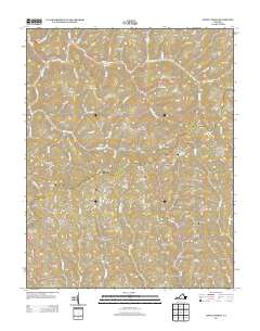
2013 Map of Jewell Ridge
USGS Topo · Published 2013About this map
Jewell Ridge and the surrounding plateau of Tazewell County are defined by a complex network of hollows and ridges that once dictated the development of the region's coal industry. Settlements such as Coaldan, Seaboard, and Afredton are concentrated along the narrow valley floors, connected by winding mountain roads like Va-620 and Va-621. The topography is a maze of named geographic features, from the heights of Sugar Cove Mountain and Stone Cove Ridge to the deep recesses of Sam King Hollow and Wildcat Hollow. Significant watercourses including Dismal Cr, Laurel Fork, and Big Cr carve through the landscape, providing the drainage for this dissected upland. The mapping detail includes a Bearwallow Lookout Tower overlooking Bearwallow Br, highlighting the era's fire watch infrastructure. This survey documents the specific arrangement of Appalachian coal towns and family-named landmarks like Stinson Ridge and Reynolds Ridge before the further modern consolidation of these rural communities.
Find a feature on this map
118 named features on this map. Tap any name to fly to it.
Don’t see what you’re looking for? This feature index may not catch every label — zoom into the map to look around manually.
Map Details
Editions of this 2013 Jewell Ridge Map
This is the sole edition of this map. No revisions or reprints were ever made.
Other maps of this area

1891 · Tazewell
USGS Topo · 1:125,000

1895 · Tazewell
USGS Topo · 1:125,000

1897 · Tazewell
USGS Topo · 1:125,000

1910 · Iaeger
USGS Topo · 1:48,000

1912 · Pounding Mill
USGS Topo · 1:62,500

1912 · Iaeger
USGS Topo · 1:62,500

1912 · Welch
USGS Topo · 1:62,500

1914 · Iaeger
USGS Topo · 1:48,000

1915 · Richlands
USGS Topo · 1:48,000

1916 · Pounding Mill
USGS Topo · 1:62,500