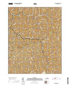
2019 Map of Jewell Ridge
USGS Topo · Published 2019About this map
Jewell Ridge straddles the high mountain border between Buchanan and Tazewell counties, serving as a focal point for a landscape defined by deep hollows and narrow ridges. The settlement pattern follows the steep topography, with homes and roads clinging to heights like Smith Ridge and Reynolds Ridge, while others are tucked into valleys along Dismal Cr near Whitewood. This 2019 survey documents a region where community history is etched into the terrain through numerous family and local burial grounds, including Company Cem and Stevenson Cem. Significant geographic features like Jewell Valley and the prominent Wolfpen Knob illustrate the complex drainage systems of the Cumberland Plateau, where waters from the W Fork Big Cr and Jones Fork carve through the coal-bearing strata of Southwest Virginia.
Find a feature on this map
121 named features on this map. Tap any name to fly to it.
Don’t see what you’re looking for? This feature index may not catch every label — zoom into the map to look around manually.
Map Details
Editions of this 2019 Jewell Ridge Map
This is the sole edition of this map. No revisions or reprints were ever made.
Other maps of this area

1891 · Tazewell
USGS Topo · 1:125,000

1895 · Tazewell
USGS Topo · 1:125,000

1897 · Tazewell
USGS Topo · 1:125,000

1910 · Iaeger
USGS Topo · 1:48,000

1912 · Pounding Mill
USGS Topo · 1:62,500

1912 · Iaeger
USGS Topo · 1:62,500

1912 · Welch
USGS Topo · 1:62,500

1914 · Iaeger
USGS Topo · 1:48,000

1915 · Richlands
USGS Topo · 1:48,000

1916 · Pounding Mill
USGS Topo · 1:62,500