
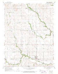
1962 Map of Jewell SW
USGS Topo · Published 1963About this map
Browns Creek Prairie and the undulating plains of North Central Kansas are meticulously documented in this 1960s-era study. The landscape is defined by the winding course of Browns Creek and the southern Solomon Rapids area, where the terrain shifts toward the drainage of Mulberry Creek and Plum Creek. This map captures a rural agricultural society organized by the section line grid, punctuated by essential community institutions. Genealogists will find significant value in the location of several remote burial grounds, including Fairview Cem, Star Cem, and Glendale Cem, which served the surrounding farmsteads. The educational and spiritual life of the era is anchored by the Pleasant Plain Sch and the Mayview Ch, while several Gravel Pits suggest the local extractive industry used for road building across the Jewell and Mitchell County line.
Find a feature on this map
13 named features on this map. Tap any name to fly to it.
Don’t see what you’re looking for? This feature index may not catch every label — zoom into the map to look around manually.
Map Details
Editions of this 1962 Jewell SW Map
This is the sole edition of this map. No revisions or reprints were ever made.
Other maps of this area

1894 · Mankato
USGS Topo · 1:125,000

1894 · Beloit
USGS Topo · 1:125,000

1953 · Solomon Rapids
USGS Topo · 1:24,000

1953 · Glen Elder South
USGS Topo · 1:24,000

1953 · Beloit
USGS Topo · 1:24,000

1955 · Beloit
USGS Topo · 1:250,000

1959 · Beloit
USGS Topo · 1:250,000

1962 · Jewell SE
USGS Topo · 1:24,000

1962 · Glen Elder North
USGS Topo · 1:24,000
1969 · Randall
USGS Topo · 1:24,000