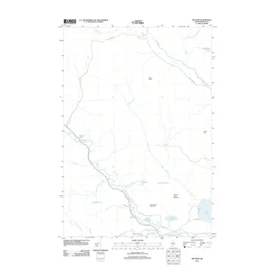
2011 Map of Jim Pond
USGS Topo · Published 2011About this map
The North Branch Dead River cuts through this Franklin County landscape, shaping a terrain of isolated mountain peaks and numerous small ponds. The geography is defined by the high elevations of the Kibby Range and Chase Pond Mountain, with the river creating significant landmarks like Sarampus Falls and Shadagee Falls. A complex network of logging and access roads, such as Gold Brook Rd and Viles Pond Rd, provides the primary infrastructure through the timberlands.
Find a feature on this map
36 named features on this map. Tap any name to fly to it.
Don’t see what you’re looking for? This feature index may not catch every label — zoom into the map to look around manually.
Map Details
Editions of this 2011 Jim Pond Map
This is the sole edition of this map. No revisions or reprints were ever made.
Other maps of this area

1928 · Chain Lakes
USGS Topo · 1:48,000

1928 · Spencer
USGS Topo · 1:48,000

1928 · Stratton
USGS Topo · 1:48,000

1932 · Stratton
USGS Topo · 1:62,500

1932 · Kennebago Lake
USGS Topo · 1:48,000

1932 · Spencer
USGS Topo · 1:62,500

1932 · Chain Lakes
USGS Topo · 1:62,500

1935 · Kennebago Lake
USGS Topo · 1:62,500

1935 · Chain Lakes
USGS Topo · 1:62,500

1936 · Kennebago Lake
USGS Topo · 1:62,500
Featured Places
- Jim Pond Township, ME
- Kibby Township, ME
- Alder Stream Township, ME
- Chain of Ponds Township, ME
- Franklin County, ME