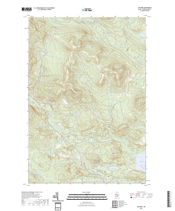
2024 Map of Jim Pond
USGS Topo · Published 2024About this map
Kibby Range dominates this landscape of the Maine woods, where a network of logging roads and remote water bodies define the terrain. The hydrological system is particularly complex, featuring the cascading waters of Sarampus Falls and Shadagee Falls along the western reaches. Numerous ponds are scattered throughout the territory, from the significant Jim Pond in the southeast to the isolated Poison Pond and Hurricane Pond. The drainage of the North Branch Dead River and its various tributaries, including Nash Brook and Gold Brook, illustrates the region's historical importance for timber transport and water power. Small clearings such as the one at the Airport near Lecours RD offer rare points of human development amidst the dense forest and prominent peaks like Chase Pond Mtn and Antler Hill.
Find a feature on this map
37 named features on this map. Tap any name to fly to it.
Don’t see what you’re looking for? This feature index may not catch every label — zoom into the map to look around manually.
Map Details
Editions of this 2024 Jim Pond Map
This is the sole edition of this map. No revisions or reprints were ever made.
Other maps of this area

1928 · Chain Lakes
USGS Topo · 1:48,000

1928 · Spencer
USGS Topo · 1:48,000

1928 · Stratton
USGS Topo · 1:48,000

1932 · Stratton
USGS Topo · 1:62,500

1932 · Kennebago Lake
USGS Topo · 1:48,000

1932 · Spencer
USGS Topo · 1:62,500

1932 · Chain Lakes
USGS Topo · 1:62,500

1935 · Kennebago Lake
USGS Topo · 1:62,500

1935 · Chain Lakes
USGS Topo · 1:62,500

1936 · Kennebago Lake
USGS Topo · 1:62,500
Featured Places
- Jim Pond Township, ME
- Kibby Township, ME
- Alder Stream Township, ME
- Chain of Ponds Township, ME
- Franklin County, ME