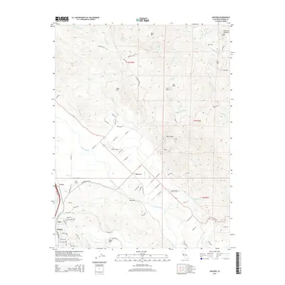
2015 Map of Jimtown
USGS Topo · Published 2015About this map
The Russian River carves a central path through this Sonoma County landscape, anchoring a series of small settlements and agricultural sites in the Alexander Valley. Jimtown sits at the junction of Alexander Valley Road and Hwy 128, surrounded by a network of rural routes like Red Winery Road and Foppiano Road. To the west, Lytton marks a historical transit point near Lytton Station Road and Lytton Lake, while the southern reaches show the early suburban footprints of Simi and Chiquita.
Find a feature on this map
90 named features on this map. Tap any name to fly to it.
Don’t see what you’re looking for? This feature index may not catch every label — zoom into the map to look around manually.
Map Details
Editions of this 2015 Jimtown Map
This is the sole edition of this map. No revisions or reprints were ever made.
Other maps of this area

1920 · Healdsburg
USGS Topo · 1:62,500

1921 · Kelseyville
USGS Topo · 1:62,500

1927 · Calistoga
USGS Topo · 1:62,500

1933 · Healdsburg
USGS Topo · 1:48,000

1940 · Healdsburg
USGS Topo · 1:62,500

1943 · Calistoga
USGS Topo · 1:62,500

1943 · Kelseyville
USGS Topo · 1:62,500

1945 · Calistoga
USGS Topo · 1:62,500

1945 · Lower Lake
USGS Topo · 1:62,500

1947 · Santa Rosa
USGS Topo · 1:250,000