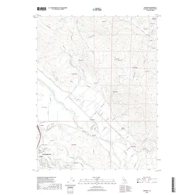
2018 Map of Jimtown
USGS Topo · Published 2018About this map
The Russian River winds through the heart of this Sonoma County landscape, shaping the valley floor where Healdsburg and several historic settlements are situated. The 2018 survey reveals a distinct pattern of agricultural use and estate development, particularly around Jimtown and the area near Soda Rock. To the northeast, the terrain rises into the Mayacmas Mountains, where landmarks like Black Mtn and Goat Rock overlook the canyons of Little Sulphur Cr and Sausal Cr.
Find a feature on this map
95 named features on this map. Tap any name to fly to it.
Don’t see what you’re looking for? This feature index may not catch every label — zoom into the map to look around manually.
Map Details
Editions of this 2018 Jimtown Map
This is the sole edition of this map. No revisions or reprints were ever made.
Other maps of this area

1920 · Healdsburg
USGS Topo · 1:62,500

1921 · Kelseyville
USGS Topo · 1:62,500

1927 · Calistoga
USGS Topo · 1:62,500

1933 · Healdsburg
USGS Topo · 1:48,000

1940 · Healdsburg
USGS Topo · 1:62,500

1943 · Calistoga
USGS Topo · 1:62,500

1943 · Kelseyville
USGS Topo · 1:62,500

1945 · Calistoga
USGS Topo · 1:62,500

1945 · Lower Lake
USGS Topo · 1:62,500

1947 · Santa Rosa
USGS Topo · 1:250,000