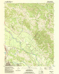
1993 Map of Jimtown
USGS Topo · Published 1993About this map
The Russian River defines the fertile valley floor of this northern Sonoma landscape, winding through the historic Sotoyome and Caslamayomi land grants. Cultivation and industry concentrate along the river's path, where the Northwestern Pacific railroad corridor passes through Lytton and the northern outskirts of Healdsburg. This 1990s revision captures the area's agricultural identity, marked by prominent labels like Red Winery Road and the small crossroads settlement of Jimtown. The Alexander Valley Community Church and Alexander Valley Sch serve as local landmarks for the valley's rural residents.
Find a feature on this map
45 named features on this map. Tap any name to fly to it.
Don’t see what you’re looking for? This feature index may not catch every label — zoom into the map to look around manually.
Map Details
Editions of this 1993 Jimtown Map
This is the sole edition of this map. No revisions or reprints were ever made.
Other maps of this area

1920 · Healdsburg
USGS Topo · 1:62,500

1921 · Kelseyville
USGS Topo · 1:62,500

1927 · Calistoga
USGS Topo · 1:62,500

1933 · Healdsburg
USGS Topo · 1:48,000

1940 · Healdsburg
USGS Topo · 1:62,500

1943 · Calistoga
USGS Topo · 1:62,500

1943 · Kelseyville
USGS Topo · 1:62,500

1945 · Calistoga
USGS Topo · 1:62,500

1945 · Lower Lake
USGS Topo · 1:62,500

1947 · Santa Rosa
USGS Topo · 1:250,000