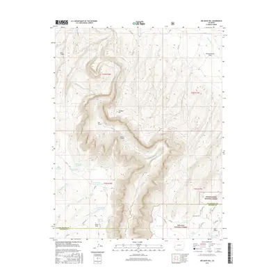
2016 Map of Joe Davis Hill
USGS Topo · Published 2016About this map
Joe Davis Hill rises above a dramatic landscape where the Dolores River carves deeply through Dolores Canyon, marking a rugged intersection of canyons and plateaus on the border of San Miguel Co and Dolores Co. This territory is defined by its water management and wilderness, with the northern reaches of the San Juan National Forest meeting the southern edge of the Uncompahgre National Forest.
Find a feature on this map
59 named features on this map. Tap any name to fly to it.
Don’t see what you’re looking for? This feature index may not catch every label — zoom into the map to look around manually.
Map Details
Editions of this 2016 Joe Davis Hill Map
This is the sole edition of this map. No revisions or reprints were ever made.
Other maps of this area

1916 · Paradox Valley
USGS Topo · 1:125,000

1922 · Paradox Valley
USGS Topo · 1:125,000

1948 · Horse Range Mesa
USGS Topo · 1:24,000

1948 · Hamm Canyon
USGS Topo · 1:24,000

1948 · Gypsum Gap
USGS Topo · 1:24,000

1949 · Gypsum Gap
USGS Topo · 1:24,000

1949 · Egnar
USGS Topo · 1:24,000

1949 · Joe Davis Hill
USGS Topo · 1:24,000

1950 · Horse Range Mesa
USGS Topo · 1:24,000
1950 · Hamm Canyon
USGS Topo · 1:24,000