Old Maps of Dolores County, Colorado
Explore 253 old maps of Dolores County, spanning from 1886 to today. These high-resolution historic maps reveal how streets, neighborhoods, landmarks, and natural features evolved over time — perfect for genealogy, metal detecting, research, and local history exploration.
What you can do with these maps:
- See how Dolores County changed over time: Compare historical maps to modern-day views to trace roads, homesites, rail lines & more.
- View detailed metadata: Each map includes creators, publishers, year, scale, and archive source.
- Overlay maps with satellite & LiDAR: Visualize the past alongside modern tools to explore terrain & human change.
- Trusted historical sources: Maps sourced from the USGS, Library of Congress, and other archives.
- Access maps your way: View online, download high-res files, or order prints for personal or research use.
Start exploring old maps of Dolores County to uncover forgotten places, hidden landmarks, and the deep history beneath your feet.
Dolores County, CO maps
(253)- 1886 Map of Abajo
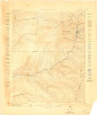
 1886 Abajo1886 Print · USGSSoutheastern Utah appears here in the late frontier era, centered on the early settlement of Bluff City along the San Juan River. Researchers can trace the path of the Old Spanish Trail or locate remote landmarks like Orejas del Oso and Abajo Peak.
 - 1892 Map of Abajo
 1892 Abajo1892 Print · USGSSoutheastern Utah in the 1890s remained a remote frontier where settlement followed the river and historic paths. Researchers can trace early routes like the Old Spanish Trail and find the riverside location of Bluff City below the Abajo Mts.
 - 1893 Map of Abajo
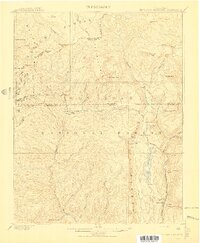
 1893 Abajo1893 Print · USGSSoutheastern Utah and the Colorado border are documented in the late nineteenth century during a time of early settlement and regional surveying. Researchers can trace the path of the Old Spanish Trail and locate early sites like Bluff City near the Navajo Indian Res. Line.5 unique versions available
 - 1897 Map of Rico
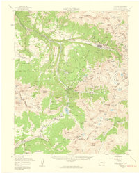
 1897 Rico1897 Print · USGSThe silver-mining hub of Rico is shown here in the late nineteenth century during its railroad-driven boom. Genealogists and researchers can locate family-named landmarks like Roger's Ranch and trace the winding route of the Rio Grande Southern R. R.
 - 1897 Map of Telluride
 1897 Telluride1897 Print · USGSMining and railroading define the San Miguel Mountains during the 1890s silver boom. Genealogists and historians can trace the foundations of Telluride and its surrounding camps, including Pandora, Ames (P.O.), and the Nellie Mine.
 - 1898 Map of Engineer Mountain, 1955 Print
 1898 Engineer Mountain1955 Print · USGSThe San Juan high country comes alive in this late nineteenth-century survey of the rugged terrain between Durango and Silverton. Researchers can trace early infrastructure like the Denver and Rio Grande RR, the Old Tollgate, and Hamor's Ranch.3 unique versions available
 - 1898 Map of Rico, 1957 Print
 1898 Rico1957 Print · USGSThe mining town of Rico and its surrounding peaks were a hub of activity in the late nineteenth century as the narrow-gauge railroad pushed through the mountains. Researchers can trace historic family holdings like Love's Ranch and the route of the Rio Grande Southern.
 - 1899 Map of Rico
 1899 Rico1899 Print · USGSThe mining town of Rico and the high San Juan peaks come into focus in the 1890s as the railroad pushes through the valley. Trace the early settlement of the West Dolores region via Waechter's Ranch, Montelores, and the winding Rio Grande Southern line.5 unique versions available
 - 1900 Map of Engineer Mountain
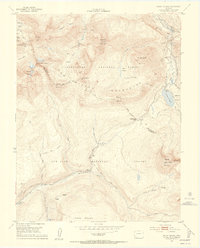
 1900 Engineer Mountain1900 Print · USGSHigh in the San Juan Mountains during the mining boom, this area served as a vital junction for four Colorado counties. Genealogists and historians can trace the Silverton Line railroad, find the Old Tollgate, and locate West Ranch.
 - 1904 Map of Telluride
 1904 Telluride1904 Print · USGSThe San Juan Mountains were at the height of their mining boom when this survey was conducted at the turn of the century. Genealogists and historians can trace the intricate rail network of the Rio Grande Southern R.R. and locate storied operations like the Smuggler Mine and the community at Ophir.2 unique versions available
 - 1908 Map of Engineer Mountain
 1908 Engineer Mountain1908 Print · USGSHigh in the San Juan Mountains during the early 1900s, this survey documents the isolation of high-altitude ranching and the arrival of industrial power. Trace the Denver and Rio Grande RR corridor past Hamor's Ranch, the Old Tollgate, and the early hydroelectric infrastructure at Tacoma.3 unique versions available
 - 1945 Map of Durango
 1945 Durango1945 Print · USGSSouthwest Colorado and Northern New Mexico at mid-century are defined by the high peaks of the San Juan Range and the tribal lands of the Southern Ute. Genealogists and historians can trace the paths of the D & R G W RR and locate local landmarks like Animas City and the Blanco Basin School.3 unique versions available
 - 1949 Map of Egnar
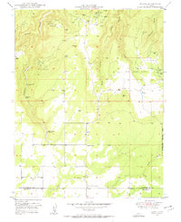 1949 Egnar1949 Print · USGSThe mining landscape near the Colorado-Utah border is detailed in this late 1940s survey. Researchers can trace numerous early claims like the Effie B Mine and Golden Rod Mines alongside local landmarks like the Egnar School.4 unique versions available
 - 1949 Map of Joe Davis Hill, 1957 Print
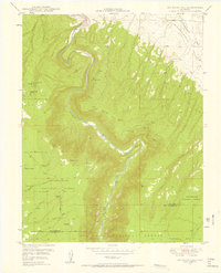 1949 Joe Davis Hill1957 Print · USGSSan Miguel and Dolores counties at the height of the mid-century uranium boom. Mineral hunters can trace the locations of the Norma Jean Mine and Mucho Grande Mine, or locate the site of Spud Patch Camp along the Dolores River.5 unique versions available
 - 1950 Map of Joe Davis Hill
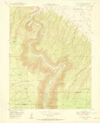 1950 Joe Davis Hill1950 Print · USGSThe Colorado mining frontier of the late 1940s comes alive in this survey of the high plateaus along the Dolores River. Local historians and researchers can trace uranium-era claims like the Sarah Ellen Mine and remote outposts such as Spud Patch Camp.2 unique versions available
 - 1950 Map of Egnar
 1950 Egnar1950 Print · USGSSouthwest Colorado mining and ranching take center stage at the turn of the fifties on the San Miguel County line. Genealogists and industrial historians can locate specific operations like the Golden Rod Mines, Effie B Mine, and the Egnar School.2 unique versions available
 - 1953 Map of Mount Wilson, 1954 Print
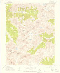
 1953 Mount Wilson1954 Print · USGSThe San Miguel Mountains in the early fifties were a hive of industrial mining activity centered around Lizard Head. Researchers can trace the Old Railroad Grade past the Butterfly Mine (Active), Matterhorn Drifts, and the settlement of Ames.8 unique versions available
 - 1953 Map of Dolores Peak, 1954 Print
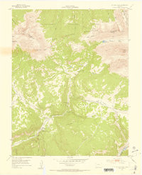 1953 Dolores Peak1954 Print · USGSThe high San Miguel and Dolores county line was a center for mining and ranching at the dawn of the atomic age. Genealogists and historians can trace the West Dolores River to find Dunton, the Emma Mine, and the Rio Grande Southern Railroad.7 unique versions available
 - 1953 Map of Durango, 1963 Print
 1953 Durango1963 Print · USGSThe high peaks of the San Juan Mountains and the Colorado mining country are shown here as they appeared in the early fifties. Genealogists and local historians can trace the rail lines of the D & R G W RR and locate historic mining camps like Silverton, Ouray, and Old Ophir.
 - 1954 Map of Durango
 1954 Durango1954 Print · USGSSouthern Colorado in the mid-1950s was defined by high-altitude mining towns and the expansion of water storage in the San Luis Valley. Trace the narrow-gauge Denver & Rio Grande Western RR as it connects Durango to mountain outposts like Silverton and Creede.2 unique versions available
 - 1955 Map of Ophir, 1957 Print
 1955 Ophir1957 Print · USGSThe high-altitude mining community of Ophir is captured here in the mid-1950s, surrounded by a complex network of industrial history and alpine basins. Researchers can trace the Old RR Grade and locate historic workings such as the Gold King Mine and the Ophir Loop Sch.7 unique versions available
 - 1955 Map of Telluride, 1959 Print
 1955 Telluride1959 Print · USGSHigh in the San Miguel Mountains during the 1950s, this area shows the peak of Colorado's mining infrastructure. Genealogists and historians can trace the Rio Grande Southern Railroad past Tomboy and the Ophir Loop Sch.5 unique versions available
 - 1956 Map of Cortez, 1972 Print
 1956 Cortez1972 Print · USGSThe Four Corners region comes alive in this mid-century study of the high plateaus and deep canyons surrounding Cortez. Trace the development of desert outposts like Towaoc or follow the historic Laramie Trail across a landscape dotted with ancient sites at Mesa Verde National Park.2 unique versions available
 - 1957 Map of Cedar 3 NW, 1958 Print
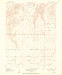
 1957 Cedar 3 NW1958 Print · USGSThe Colorado canyon lands at the mid-century mark reveal a landscape of high plateaus and deep drainages. Researchers can locate the School (Aban'd) near Squaw Canyon or trace early water sources like Champagne Spring and Lower Monument Reservoir.
 - 1957 Map of Aneth 1 NE, 1958 Print
 1957 Aneth 1 NE1958 Print · USGSThe high desert borderlands of Utah and Colorado appear here in the mid-1950s, centered on the ancient structures of Hovenweep National Monument. Researchers can locate specific sites like Hovenweep House and Round Tower or trace historic travel routes including Old Bluff Road and various Jeep Trails.
Showing maps 1-25 of 253
Top cities of Dolores County
Frequently asked questions
- What are the different types of historical maps available for Dolores County?
- What is the oldest map of Dolores County?
- Where can I purchase historical maps of Dolores County for my home or office?
- Where can I download high-res historical maps of Dolores County?
- Are there historical topographic maps available for Dolores County?
- Is there historical aerial imagery available for Dolores County?
- Where are historical maps of Dolores County sourced from?