1960s Maps of Dolores County, Colorado
Explore 26 historic maps of Dolores County from the 1960s. These maps offer a rare glimpse into what life looked like during the 1960s — showing old roads, neighborhoods, homes, and landmarks that have changed or disappeared over time.
Whether you're researching your family's past, planning a metal detecting trip, or studying how Dolores County's landscape evolved across the 1960s, these high-resolution maps are a powerful tool for exploring the history of this region.
- Focus on a specific era: All maps on this page are from the 1960s, giving you a focused view of this time period.
- See what’s changed: Compare century-old streets, trails, and buildings to today's modern landscape using overlays and satellite layers.
- Research with precision: Use these maps for genealogy, historical research, land use analysis, or educational projects.
- View, download, or print: Maps are fully viewable online in high resolution, and can be downloaded or printed for your own records.
Start exploring Dolores County's history through authentic maps from the 1960s. This is your window into the past.
Dolores County, CO maps
(26)- 1960 Map of Hermosa Peak, 1962 Print
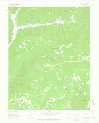
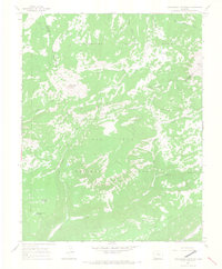
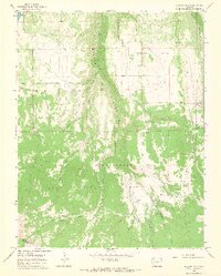
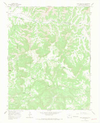
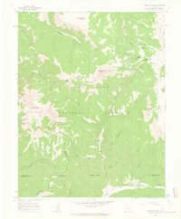 1960 Hermosa Peak1962 Print · USGSHigh in the Rico Mountains during the early sixties, this area shows the intersection of four Colorado counties amid mining and forest lands. Researchers can trace historic extraction sites like the Spanish King No 1 Mine and navigate through Bolam Pass or Tin Can Basin.4 unique versions available
 - 1960 Map of Engineer Mountain, 1962 Print
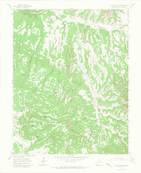
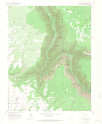
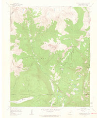 1960 Engineer Mountain1962 Print · USGSThe high San Juan Mountains are documented here in the early sixties as a rugged intersection of forest management and early recreation. Researchers can trace the routes of the Highline Trail, locate Harris Ranch, and identify historic sites like the Columbine Ranger Sta.7 unique versions available
 - 1960 Map of Rico, 1963 Print
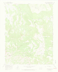
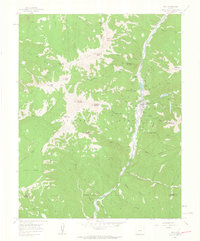 1960 Rico1963 Print · USGSRico and the upper Dolores River valley appear here in the early sixties, highlighting a landscape defined by mining and mountain transit. Genealogists and historians can trace old operations like the Enterprise Mine and the winding path of the Old Railroad Grade.4 unique versions available
 - 1961 Map of Durango
 1961 Durango1961 Print · USGSThe high San Juan country in the early sixties is shown here as a network of historic mining towns and early reservoir projects. Genealogists and researchers can trace the Denver & Rio Grande Western RR as it connects Durango, Silverton, and Arboles.
 - 1962 Map of Cortez
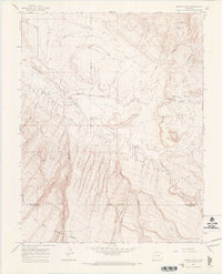
 1962 Cortez1962 Print · USGSThe Four Corners region comes alive in the early sixties, showing a landscape defined by reservation lands and federal forests. Trace the route of the Rio Grande Southern RR or locate the Uranium and vanadium mines near Monticello.
 - 1963 Map of Durango
 1963 Durango1963 Print · USGSThe San Juan Mountains and San Luis Valley are captured here in the early 1950s as mining, rail, and tribal lands shaped the region. Researchers can trace the Denver & Rio Grande Western RR through high-country towns like Telluride and Silverton, or locate landmarks such as the Asiatic Mine.
 - 1963 Map of Nipple Mountain, 1965 Print
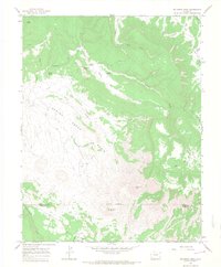
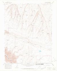
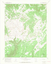
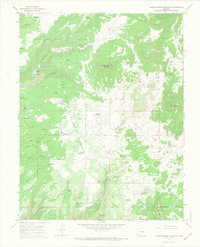
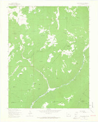 1963 Nipple Mountain1965 Print · USGSThe high country of the San Juan National Forest comes into focus during the early sixties, showing a landscape of river-fed canyons and ranching outposts. Trace family history or old trails near King Ranch, Cottonwood Guard Station, and the many reservoirs dotting Stoner Mesa.4 unique versions available
 - 1963 Map of Clyde Lake, 1965 Print
 1963 Clyde Lake1965 Print · USGSHigh country ranching and forestry define this Colorado landscape in the early sixties, as seen through the river valleys and timbered mesas. Researchers can trace historic pack routes like the Johnny Bull Trail and locate family holdings such as Miller Ranch and Cesto Ranch.4 unique versions available
 - 1964 Map of Groundhog Reservoir, 1968 Print
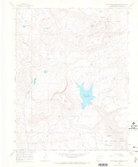 1964 Groundhog Reservoir1968 Print · USGSThe San Juan National Forest landscape in the mid-1960s was a network of high-country water storage and trails. Trace remote landmarks like Lavender Sch, Groundhog Reservoir, and the Jeep Trail through Boggy Basin.
 - 1964 Map of Dawson Draw, 1968 Print
 1964 Dawson Draw1968 Print · USGSThe high plateau country of San Miguel and Dolores counties is captured here in the mid-1960s, showing a landscape defined by deep draws and remote forest boundaries. Researchers can locate specific ranching infrastructure like Daddy Williams Bridge and trace early irrigation via Custer Ditch and Horseshoe Ditch.3 unique versions available
 - 1964 Map of Lone Cone, 1968 Print
 1964 Lone Cone1968 Print · USGSThe high ranching country of San Miguel and Dolores Counties is captured here in the early 1960s as seasonal camps supported the region's livestock. Researchers can trace historic access routes like Beef Trail Road and locate family-named landmarks including Scotties Cabin and Redd Ranchs Summer Camp.5 unique versions available
 - 1964 Map of Groundhog Mountain, 1968 Print
 1964 Groundhog Mountain1968 Print · USGSHigh-country forests and mesas along the San Miguel and Dolores county line are captured here in the mid-1960s. Researchers can trace historic water management and routes through Joe Redd Reservoir, the Pack Trail, and landmarks like Groundhog Mountain.2 unique versions available
 - 1964 Map of Glade Mountain, 1968 Print
 1964 Glade Mountain1968 Print · USGSDolores County in the mid-sixties reveals a landscape of high-country water management and national forest conservation. You can trace early backcountry access and ranching infrastructure through features like the Lookout Tower, Beef Trail Reservoir, and Bradfield Spring.4 unique versions available
 - 1964 Map of North Mountain, 1968 Print
 1964 North Mountain1968 Print · USGSThe Colorado high country along the San Miguel and Dolores county line is captured in the mid-1960s, showing a landscape shaped by ranching and seasonal water. Genealogists and local historians can locate remote outposts like Sandys Fort and Jensens Cow Camp or trace the route of the Lilylands Canal.2 unique versions available
 - 1964 Map of Mc Kenna Peak, 1968 Print
 1964 Mc Kenna Peak1968 Print · USGSThe high plateau of San Miguel and Dolores Counties is captured here in the mid-1960s, showing the remote ranching and homesteading life of Southwest Colorado. Researchers can trace historic land use through the Bassinet Homestead, Heldman Homestead, and the irrigation network of Custer Ditch.3 unique versions available
 - 1964 Map of Beaver Park, 1968 Print
 1964 Beaver Park1968 Print · USGSSan Miguel County's high forest and mesa lands are captured in the mid-sixties before modern development altered these remote drainages. Researchers can trace the legacy of high-country ranching and forest management through Beef Trail Road, Taylor Camp, and the Lone Cone Guard Station.2 unique versions available
 - 1964 Map of Secret Canyon, 1968 Print
 1964 Secret Canyon1968 Print · USGSThe Dolores River corridor in the mid-1960s was a rugged landscape of isolated springs and upland reservoirs. Researchers can trace land use through landmarks like the Dove Creek Pumping Sta, Mountain Sheep Point, and the Radio Facility.2 unique versions available
 - 1964 Map of The Glade, 1968 Print
 1964 The Glade1968 Print · USGSDolores County in the mid-1960s shows a high-plateau landscape defined by remote water improvements and forestry management. Genealogists and historians can trace the network of springs and tanks like Tom Westcott Spring and the Glade Guard Sta.3 unique versions available
 - 1964 Map of Dove Creek, 1968 Print
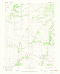 1964 Dove Creek1968 Print · USGSDove Creek stands as a vital crossroads near the Utah state line in the mid-1960s. Researchers can trace rural infrastructure and local landmarks like the Peel Cem, the town's Grain Elevator, and the local Drive-in Theater.3 unique versions available
 - 1964 Map of South Mountain, 1968 Print
 1964 South Mountain1968 Print · USGSDolores County’s high country in the mid-1960s was a landscape of remote timberlands and high-altitude springs. Researchers can find isolated landmarks like Nash Cem or trace the water sources at Lone Mesa Reservoir and Browning Spring.3 unique versions available
 - 1965 Map of Cahone, 1967 Print
 1965 Cahone1967 Print · USGSThe high plateau of Dolores County is captured here in the mid-sixties as the community of Cahone sits at a vital crossroads. Genealogists and local historians can locate the Cahone Sch, the Cahone Ch, and tracing the rugged path of Cross Canyon.2 unique versions available
 - 1965 Map of Willow Spring, 1967 Print
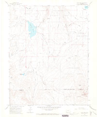
 1965 Willow Spring1967 Print · USGSThe Dolores and Montezuma county line in the mid-1960s is defined by a dense network of upland water reservoirs and ranching infrastructure. Researchers can trace the path of the Old Railroad Grade or locate historic sites like the Willow Spring Guard Station and Sagebrush Spring.2 unique versions available
 - 1965 Map of Doe Canyon, 1968 Print
 1965 Doe Canyon1968 Print · USGSThe mid-century Dolores River corridor is captured here as it winds through the heart of the San Juan National Forest. Genealogists and historians can trace family-named sites like Bradfield Ranch and Imel or locate remote water sources such as Ferris Spring.2 unique versions available
 - 1965 Map of Narraguinnep Mountain, 1968 Print
 1965 Narraguinnep Mountain1968 Print · USGSHigh forest ranges near the Dolores and Montezuma County line appear here in the mid-1960s, showing a landscape shaped by water management and grazing. Local history researchers can trace numerous named water sources like Hosea Reservoir, Narraguinnep Spring, and the high peak of Narraguinnep Mountain.4 unique versions available
 - 1966 Map of Cortez
 1966 Cortez1966 Print · USGSThe Four Corners region in the mid-sixties reveals a landscape of high mesas, tribal lands, and archaeological preserves. Researchers can trace the ancient sites at Hovenweep National Monument, follow the Denver & Rio Grande Western Railroad, or locate old settlements like Ginger Hill and Yellow Jacket.
Showing maps 1-25 of 26
Top cities of Dolores County
Frequently asked questions
- What are the different types of historical maps available for Dolores County?
- What is the oldest map of Dolores County?
- Where can I purchase historical maps of Dolores County for my home or office?
- Where can I download high-res historical maps of Dolores County?
- Are there historical topographic maps available for Dolores County?
- Is there historical aerial imagery available for Dolores County?
- Where are historical maps of Dolores County sourced from?