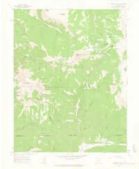
1960 Map of Hermosa Peak
USGS Topo · Published 1962About this map
San Juan National Forest defines this high-elevation landscape, where the headwaters of the Dolores River and Hermosa Creek converge among prominent peaks of the Rico Mountains. In the early 1960s, this area remained a hub of mountain activity, evidenced by the Spanish King No 1 Mine and Graysill Mine. The terrain is marked by significant elevation changes, from the heights of Hermosa Peak and Blackhawk Mountain down to deep drainages like Black Canyon and Horse Canyon.
Find a feature on this map
42 named features on this map. Tap any name to fly to it.
Don’t see what you’re looking for? This feature index may not catch every label — zoom into the map to look around manually.
Map Details
Editions of this 1960 Hermosa Peak Map
4 editions found
Other maps of this area

1897 · Rico
USGS Topo · 1:62,500

1897 · Telluride
USGS Topo · 1:62,500

1898 · Engineer Mountain
USGS Topo · 1:62,500

1898 · Rico
USGS Topo · 1:62,500

1899 · Rico
USGS Topo · 1:62,500

1900 · Engineer Mountain
USGS Topo · 1:62,500

1904 · Telluride
USGS Topo · 1:62,500

1908 · Engineer Mountain
USGS Topo · 1:62,500

1945 · Durango
USGS Topo · 1:250,000

1953 · Mount Wilson
USGS Topo · 1:24,000