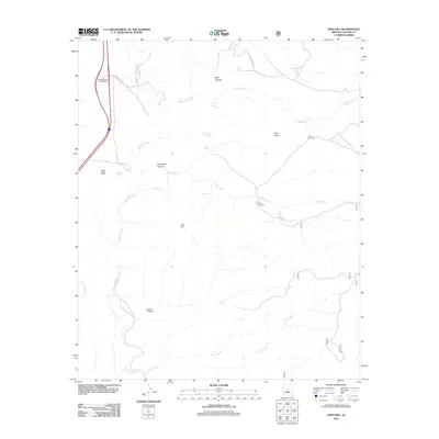
2011 Map of Joes Hill
USGS Topo · Published 2011About this map
The Agua Fria River carves a deep path through this high desert region of Yavapai County, defining a landscape dominated by expansive plateaus and drainage systems. Perry Mesa and Black Mesa stand as prominent landforms, overlooking a network of named canyons including Baby Canyon, Lousy Canyon, and Perry Tank Canyon. The presence of numerous water management features like Perry Windmill, New Windmill, and various cattle tanks such as Bull Tank and Lousy Tank reflects the ranching history and necessity of water in this arid environment. Transportation is anchored by the Badger Spring Interchange and Bloody Basin Rd, while smaller watercourses like Bishop Creek and Larry Creek feed into the primary river valley, marking the complex hydrology of the high desert before it drops into the lower basins.
Find a feature on this map
35 named features on this map. Tap any name to fly to it.
Don’t see what you’re looking for? This feature index may not catch every label — zoom into the map to look around manually.
Map Details
Editions of this 2011 Joes Hill Map
This is the sole edition of this map. No revisions or reprints were ever made.
Other maps of this area

1887 · Verde
USGS Topo · 1:250,000

1887 · Prescott
USGS Topo · 1:250,000

1892 · Verde
USGS Topo · 1:250,000

1892 · Prescott
USGS Topo · 1:250,000

1903 · Bradshaw Mountains
USGS Topo · 1:125,000

1929 · Turret Peak
USGS Topo · 1:125,000

1933 · Turret Peak
USGS Topo · 1:125,000

1947 · Bumblebee
USGS Topo · 1:62,500

1947 · Mayer
USGS Topo · 1:62,500

1948 · Bumblebee
USGS Topo · 1:63,360