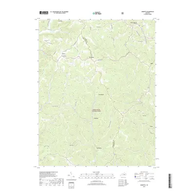
2019 Map of Johnetta
USGS Topo · Published 2019About this map
Daniel Boone National Forest defines the deeply dissected landscape of this 2019 survey, where the boundary between Jackson and Rockcastle County follows the winding ridges. The map documents a network of rural settlements including Threelinks, Climax, and Johnetta, which are connected by narrow ridge-top roads such as Climax Rd and Three Links Rd. Local history is preserved through numerous family and community sites, such as the Chastine Cem, King and Clark Cem, and the Johnson School near Limestone Br. The drainage patterns of Horse Lick Cr and Brushy Creek illustrate how the geography dictated the placement of early homesteads and transport routes like the Brush Cr Station in the southwest. This edition provides a detailed view of the contemporary interface between public forest lands and private holdings in the Kentucky hills.
Find a feature on this map
54 named features on this map. Tap any name to fly to it.
Don’t see what you’re looking for? This feature index may not catch every label — zoom into the map to look around manually.
Map Details
Editions of this 2019 Johnetta Map
This is the sole edition of this map. No revisions or reprints were ever made.
Other maps of this area

1892 · Richmond
USGS Topo · 1:125,000

1893 · London
USGS Topo · 1:125,000

1897 · Richmond
USGS Topo · 1:125,000

1897 · London
USGS Topo · 1:125,000

1952 · Alcorn
USGS Topo · 1:24,000

1952 · Berea
USGS Topo · 1:24,000

1952 · Bighill
USGS Topo · 1:24,000

1953 · Johnetta
USGS Topo · 1:24,000

1953 · Sandgap
USGS Topo · 1:24,000

1953 · Wildie
USGS Topo · 1:24,000