
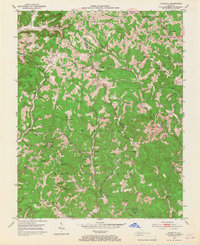
1953 Map of Johnetta
USGS Topo · Published 1954About this map
Cumberland National Forest land defines the southern reaches of this mid-century survey along the border of Rockcastle and Jackson Counties. The landscape is marked by a network of rural schools and small community centers including Johnetta, Climax, and Goochland. Resource extraction is evident through scattered Strip Mines and a Quarry near Clover Bottom, reflecting the region's industrial activity in the early 1950s.
Find a feature on this map
48 named features on this map. Tap any name to fly to it.
Don’t see what you’re looking for? This feature index may not catch every label — zoom into the map to look around manually.
Map Details
Editions of this 1953 Johnetta Map
4 editions found
Other maps of this area

1892 · Richmond
USGS Topo · 1:125,000

1893 · London
USGS Topo · 1:125,000

1897 · Richmond
USGS Topo · 1:125,000

1897 · London
USGS Topo · 1:125,000

1952 · Alcorn
USGS Topo · 1:24,000

1952 · Berea
USGS Topo · 1:24,000

1952 · Bighill
USGS Topo · 1:24,000

1953 · Sandgap
USGS Topo · 1:24,000

1953 · Wildie
USGS Topo · 1:24,000

1953 · Livingston
USGS Topo · 1:24,000