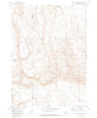
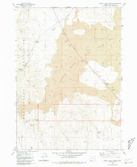
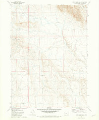
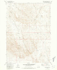
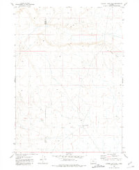
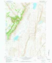
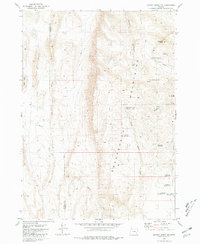
1981 Map of Johnny Creek SW
USGS Topo · Published 1981About this map
The Sheepshead Mountains dominate this high-desert landscape along the border of Harney and Malheur counties, showing a region defined by complex topography and critical water management. The 1981 survey details an arid environment where ranching and land use relied heavily on a network of springs and man-made catchments, such as Antelope Spring No 4 and Three Forks Reservoir. Notable landmarks like Table Mountain provide a dramatic backdrop to the winding course of Wildcat Creek and the deep incision of Mickey Canyon. This map records a specific infrastructure of remote survival, from the Table Mountain Well to several namesake reservoirs like Bobcat Reservoir and Wildcat Reservoir, which supported the livestock and movement through this corner of the Oregon desert before the modernization of rural access.
Find a feature on this map
23 named features on this map. Tap any name to fly to it.
Don’t see what you’re looking for? This feature index may not catch every label — zoom into the map to look around manually.
Map Details
Editions of this 1981 Johnny Creek SW Map
This is the sole edition of this map. No revisions or reprints were ever made.
Other maps of this area

1955 · Adel
USGS Topo · 1:250,000

1957 · Adel
USGS Topo · 1:250,000

1958 · Adel
USGS Topo · 1:250,000

1962 · Adel
USGS Topo · 1:250,000
1980 · Johnny Creek Spring
USGS Topo · 1:24,000
1981 · Grassy Ridge Well
USGS Topo · 1:24,000
1981 · Groan Canyon
USGS Topo · 1:24,000
1981 · Ancient Lake Well
USGS Topo · 1:24,000
1981 · Juniper Lake
USGS Topo · 1:24,000
1981 · Johnny Creek NW
USGS Topo · 1:24,000