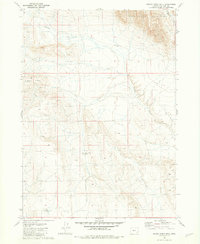
1981 Map of Grassy Ridge Well
USGS Topo · Published 1981About this map
Sheepshead Mountains dominate the northern landscape of this Malheur County quadrangle, where the high desert terrain transitions into deep drainage systems. The namesake Grassy Ridge Well and an adjacent Water Tank serve as critical landmarks in an arid expanse defined by significant elevation changes. Water management and livestock support are central to the human footprint here, as evidenced by these specific installations situated along Grassy Ridge.
Find a feature on this map
6 named features on this map. Tap any name to fly to it.
Don’t see what you’re looking for? This feature index may not catch every label — zoom into the map to look around manually.
Map Details
Editions of this 1981 Grassy Ridge Well Map
This is the sole edition of this map. No revisions or reprints were ever made.
Other maps of this area

1955 · Jordan Valley
USGS Topo · 1:250,000

1955 · Adel
USGS Topo · 1:250,000

1957 · Adel
USGS Topo · 1:250,000

1957 · Jordan Valley
USGS Topo · 1:250,000

1958 · Adel
USGS Topo · 1:250,000

1958 · Jordan Valley
USGS Topo · 1:250,000

1962 · Adel
USGS Topo · 1:250,000

1972 · Palomino Hills
USGS Topo · 1:24,000
1980 · Flat Top Mtn
USGS Topo · 1:24,000

1980 · Rome State Airport
USGS Topo · 1:24,000