
1980 Map of Rome State Airport
USGS Topo · Published 1980About this map
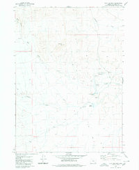
Rome State Airport stands as the primary infrastructure landmark in this high desert landscape of Malheur County. This 1980 edition, based on field checks from the mid-1970s, reveals a terrain defined more by its elevation contours than by human settlement. The presence of a Jeep Trail winding through the southeastern sections and a solitary Borrow Pit near the eastern boundary suggests a region focused on utility and basic transport links rather than residential development. This map serves as a clear record of the area's arid character and sparse industrial footprint during the late twentieth century.
Find a feature on this map
3 named features on this map. Tap any name to fly to it.
Don’t see what you’re looking for? This feature index may not catch every label — zoom into the map to look around manually.
Map Details
Editions of this 1980 Rome State Airport Map
This is the sole edition of this map. No revisions or reprints were ever made.
Other maps of this area

1955 · Jordan Valley
USGS Topo · 1:250,000

1955 · Adel
USGS Topo · 1:250,000

1957 · Adel
USGS Topo · 1:250,000

1957 · Jordan Valley
USGS Topo · 1:250,000

1958 · Adel
USGS Topo · 1:250,000

1958 · Jordan Valley
USGS Topo · 1:250,000

1962 · Adel
USGS Topo · 1:250,000

1979 · Anderson Reservoir
USGS Topo · 1:24,000

1979 · Flat Top Mtn SE
USGS Topo · 1:24,000
1980 · Flat Top Mtn
USGS Topo · 1:24,000