
1979 Map of Anderson Reservoir
USGS Topo · Published 1980About this map
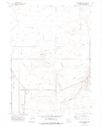
Anderson Reservoir anchors this high-desert landscape in Malheur County, where water management is the primary shaper of human activity. An Aqueduct feeds toward the central reservoir, supporting the isolated infrastructure required for ranching or land management in this arid reach of eastern Oregon. Evidence of human presence is sparse but deliberate, marked by a remote Landing Strip and scattered ruins that suggest the difficulty of maintaining permanent settlement here. The terrain is defined by the Black Hills and Red Hills, with drainages like Drought Creek, Crooked Creek, and Rattlesnake Creek carving paths through the volcanic topography. A lone section of Highway 95 clips the western edge, providing the only major transit link through this expansive open country during the late 1970s.
Find a feature on this map
17 named features on this map. Tap any name to fly to it.
Don’t see what you’re looking for? This feature index may not catch every label — zoom into the map to look around manually.
Map Details
Editions of this 1979 Anderson Reservoir Map
This is the sole edition of this map. No revisions or reprints were ever made.
Other maps of this area

1955 · Jordan Valley
USGS Topo · 1:250,000

1957 · Jordan Valley
USGS Topo · 1:250,000

1958 · Jordan Valley
USGS Topo · 1:250,000

1972 · Palomino Hills
USGS Topo · 1:24,000

1972 · Rome
USGS Topo · 1:24,000
1972 · Burns Junction
USGS Topo · 1:24,000

1979 · Bowden Ranch
USGS Topo · 1:24,000

1979 · Flat Top Mtn SE
USGS Topo · 1:24,000
1979 · The Basin
USGS Topo · 1:24,000
1980 · Flat Top Mtn
USGS Topo · 1:24,000