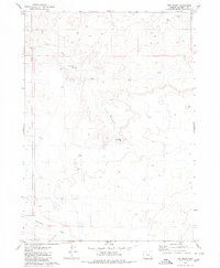
1979 Map of The Basin
USGS Topo · Published 1980About this map
The Basin dominates this landscape in Malheur County, where the high desert terrain is defined by its seasonal water sources and expansive plateaus. Surveyed in the 1970s, this map captures a remote corner of eastern Oregon where survival and land use were centered on scattered improvements like Smiths Well and Winter Range Well. The drainage patterns of Dry Creek and Rattlesnake Creek reveal the natural flow of the land toward the southern Red Hills. Transportation through this territory is limited to a primitive Jeep Trail, illustrating the isolation of this ranching or grazing country during the late twentieth century. This sheet is particularly useful for those studying the history of land management and water rights in one of Oregon's most sparsely populated regions.
Find a feature on this map
8 named features on this map. Tap any name to fly to it.
Don’t see what you’re looking for? This feature index may not catch every label — zoom into the map to look around manually.
Map Details
Editions of this 1979 The Basin Map
This is the sole edition of this map. No revisions or reprints were ever made.
Other maps of this area

1955 · Jordan Valley
USGS Topo · 1:250,000

1957 · Jordan Valley
USGS Topo · 1:250,000

1958 · Jordan Valley
USGS Topo · 1:250,000

1972 · Rome
USGS Topo · 1:24,000
1972 · Scott Reservoir
USGS Topo · 1:24,000
1972 · Burns Junction
USGS Topo · 1:24,000

1979 · Rockhouse Reservoir
USGS Topo · 1:24,000

1979 · Bowden Ranch
USGS Topo · 1:24,000

1979 · Anderson Reservoir
USGS Topo · 1:24,000

1979 · Flat Top Mtn SE
USGS Topo · 1:24,000