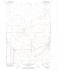
1972 Map of Burns Junction
USGS Topo · Published 1975About this map
Burns Junction serves as the primary focal point of this high desert landscape, situated at a critical crossroads in Malheur County. The map captures the area as it appeared in the early 1970s, defined by the prominent volcanic profile of Scott Butte and the drainage patterns of Palomino Creek and Crooked Creek. Infrastructure in this sparsely populated region is limited to essential ranching and transit features, including a localized Landing Strip and a series of Jeep Trails that navigate the sagebrush-covered terrain.
Find a feature on this map
12 named features on this map. Tap any name to fly to it.
Don’t see what you’re looking for? This feature index may not catch every label — zoom into the map to look around manually.
Map Details
Editions of this 1972 Burns Junction Map
This is the sole edition of this map. No revisions or reprints were ever made.
Other maps of this area

1955 · Jordan Valley
USGS Topo · 1:250,000

1957 · Jordan Valley
USGS Topo · 1:250,000

1958 · Jordan Valley
USGS Topo · 1:250,000

1972 · Palomino Hills
USGS Topo · 1:24,000

1972 · Owyhee Butte
USGS Topo · 1:24,000
1972 · Palomino Lake
USGS Topo · 1:24,000

1972 · Rome
USGS Topo · 1:24,000
1972 · Iron Mountain
USGS Topo · 1:24,000

1979 · Anderson Reservoir
USGS Topo · 1:24,000
1979 · The Basin
USGS Topo · 1:24,000