1981 Map of Groan Canyon
USGS Topo · Published 1981About this map
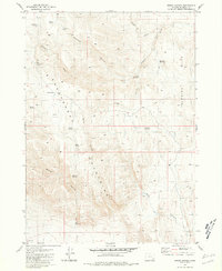
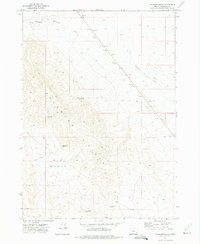
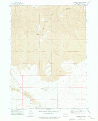
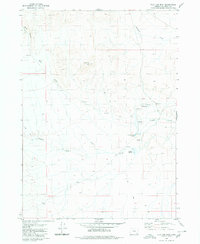
The Sheepshead Mountains dominate this high-desert landscape in Malheur County, where a network of seasonal water sources supported ranching operations in the late 1970s. The map illustrates a rugged topography defined by deep drainage systems like Groan Canyon and Mickey Canyon, punctuated by essential water points such as Rock Corral Spring and Little Hole Spring. Small-scale water management is evident through several named catchments including Stoddart Reservoir, Hub Reservoir, and Red Line Reservoir, which suggest the vital importance of water rights and livestock grazing in this arid region of Southeast Oregon.
Find a feature on this map
27 named features on this map. Tap any name to fly to it.
Don’t see what you’re looking for? This feature index may not catch every label — zoom into the map to look around manually.
Map Details
Editions of this 1981 Groan Canyon Map
This is the sole edition of this map. No revisions or reprints were ever made.
Other maps of this area

1955 · Jordan Valley
USGS Topo · 1:250,000

1955 · Adel
USGS Topo · 1:250,000

1957 · Adel
USGS Topo · 1:250,000

1957 · Jordan Valley
USGS Topo · 1:250,000

1958 · Adel
USGS Topo · 1:250,000

1958 · Jordan Valley
USGS Topo · 1:250,000

1962 · Adel
USGS Topo · 1:250,000
1972 · Palomino Hills
USGS Topo · 1:24,000
1972 · Palomino Lake
USGS Topo · 1:24,000
1980 · Flat Top Mtn
USGS Topo · 1:24,000