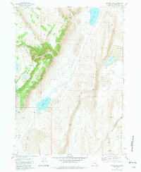
1981 Map of Juniper Lake
USGS Topo · Published 1981About this map
The high desert landscape of Harney County is defined here by the towering heights of Steens Mountain and the distinct volcanic depressions of the Alvord Basin. This 1981 survey documents a remote ranching environment where water sources like Negro Springs, Neal Spring, and Flowing Wells were essential for survival. Traces of early 20th-century settlement appear at the Ruins near Alberson and the Tudor Barn (Ruins) located along the edge of Tudor Lake.
Find a feature on this map
27 named features on this map. Tap any name to fly to it.
Don’t see what you’re looking for? This feature index may not catch every label — zoom into the map to look around manually.
Map Details
Editions of this 1981 Juniper Lake Map
This is the sole edition of this map. No revisions or reprints were ever made.
Other maps of this area

1955 · Burns
USGS Topo · 1:250,000

1955 · Adel
USGS Topo · 1:250,000

1957 · Adel
USGS Topo · 1:250,000

1958 · Burns
USGS Topo · 1:250,000

1958 · Adel
USGS Topo · 1:250,000

1959 · Burns
USGS Topo · 1:250,000

1962 · Adel
USGS Topo · 1:250,000

1974 · Anderson Mtn
USGS Topo · 1:62,500
1974 · Folly Farm
USGS Topo · 1:24,000
1974 · Folly Farm
USGS Topo · 1:62,500