2024 Map of Johnsonville
USGS Topo · Published 2024About this map
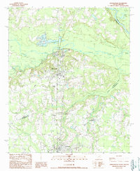
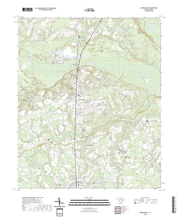
Johnsonville sits at the heart of this South Carolina landscape, where the Lynches River flows toward its confluence with the Great Pee Dee River in the northeast. The geography is defined by an intricate network of wetlands, including Moodys Swamp, Owens Swamp, and Lake Swamp, which have historically shaped the settlement patterns and transport routes of Florence and Williamsburg Counties. The map documents several important rural crossroads such as Venters, Ard Crossroads, and Muddy Creek Crossroads, reflecting the agricultural and social centers that anchor the region.
Find a feature on this map
145 named features on this map. Tap any name to fly to it.
Don’t see what you’re looking for? This feature index may not catch every label — zoom into the map to look around manually.
Map Details
Editions of this 2024 Johnsonville Map
This is the sole edition of this map. No revisions or reprints were ever made.
Historical Maps of Venters Through Time
3 maps found