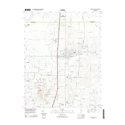
2015 Map of Johnston City
USGS Topo · Published 2015About this map
Johnston City serves as the central hub of this Southern Illinois landscape, where the residential grids of the city meet the industrial and agricultural corridors of Williamson and Franklin counties. The map documents a dense network of family and community history, evidenced by the numerous burial grounds such as Jacob Hunter Cem, Follis Cem, and the Stroud-Sehoskey Cem. Smaller named settlements like Stiritz, Shakerag, and White Ash are scattered throughout, illustrating the early 21st-century distribution of communities between the larger centers of West Frankfort and Marion. Hydrological features including Lake Creek and Bear Creek wind through the terrain, while the Johnston City Sewage Lagoon and various numbered water bodies like Lake Number 1 indicate the area's utility and natural resource management. This survey provides an essential record for researchers tracing the evolution of these distinct coal-belt neighborhoods and rural family outposts.
Find a feature on this map
114 named features on this map. Tap any name to fly to it.
Don’t see what you’re looking for? This feature index may not catch every label — zoom into the map to look around manually.
Map Details
Editions of this 2015 Johnston City Map
This is the sole edition of this map. No revisions or reprints were ever made.
Other maps of this area

1909 · West Frankfort
USGS Topo · 1:62,500

1910 · Herrin
USGS Topo · 1:62,500

1922 · Carbondale
USGS Topo · 1:62,500

1925 · Marion
USGS Topo · 1:62,500

1936 · Herrin
USGS Topo · 1:62,500

1940 · Marion
USGS Topo · 1:62,500

1941 · Carbondale
USGS Topo · 1:62,500

1941 · West Frankfort
USGS Topo · 1:62,500

1949 · Paducah
USGS Topo · 1:250,000

1950 · Paducah
USGS Topo · 1:250,000