2021 Map of Johnstown
USGS Topo · Published 2021About this map
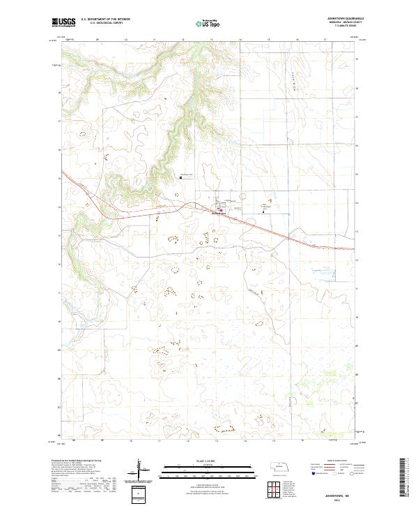
Johnstown serves as the central hub of this Nebraska Sandhills landscape, situated where Main St and Center St intersect. The settlement pattern is defined by the east-west passage of the Cowboy Trl, a recreational route tracing a former railroad corridor through Brown County. This 2021 survey illustrates the essential role of water management in the region, featuring the Ainsworth Canal as it cuts across the prairie south of town. The surrounding terrain is a network of drainage systems, including the meandering Plum Cr and its tributaries, such as the South Fork Plum Creek and N Fork Plum Cr. Local history is anchored by the Woodlawn Cem to the northwest and the East Woodlawn Cem located east of the village center, providing specific points of interest for genealogical research in this sparsely populated cattle country.
Find a feature on this map
24 named features on this map. Tap any name to fly to it.
Don’t see what you’re looking for? This feature index may not catch every label — zoom into the map to look around manually.
Map Details
Editions of this 2021 Johnstown Map
This is the sole edition of this map. No revisions or reprints were ever made.