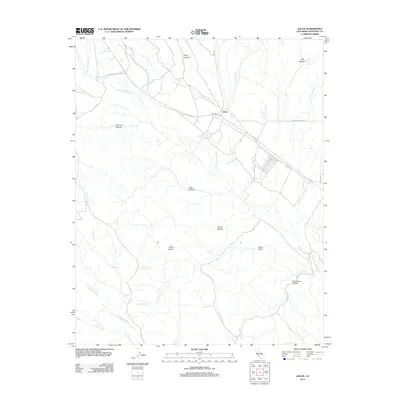
2012 Map of Jolon
USGS Topo · Published 2012About this map
The settlement of Jolon sits at a crossroads of early California history, positioned where Mission Rd and Lockwood Jolon Rd meet near the San Antonio River. This landscape is defined by its deep canyons and arroyos, including Oro Fino Canyon, Lugo Canyon, and Ruby Canyon, which drain into a network of waterways like Jolon Cr and Murry Cr. To the south, the terrain becomes increasingly complex around Mesa Coyote and China Gulch, leading toward the Nacimiento River. The distribution of these features reflects a region shaped by ranching and transit, where local water sources like Agua Fria Cr and El Piojo Cr were essential for survival in the dry coastal mountains. Historical researchers can trace the movement of early travel along routes like Nacimiento-Fergusson Rd, which climbs toward the ridges above Twin Valley Cr.
Find a feature on this map
23 named features on this map. Tap any name to fly to it.
Don’t see what you’re looking for? This feature index may not catch every label — zoom into the map to look around manually.
Map Details
Editions of this 2012 Jolon Map
This is the sole edition of this map. No revisions or reprints were ever made.
Other maps of this area

1919 · King City
USGS Topo · 1:62,500

1919 · Junipero Serra
USGS Topo · 1:62,500

1919 · Bryson
USGS Topo · 1:62,500

1921 · Cape San Martin
USGS Topo · 1:62,500

1939 · King City
USGS Topo · 1:62,500

1941 · Cape San Martin
USGS Topo · 1:62,500

1941 · Junipero Serra
USGS Topo · 1:62,500

1941 · Bryson
USGS Topo · 1:62,500

1942 · Bryson
USGS Topo · 1:62,500

1942 · Cape San Martin
USGS Topo · 1:62,500