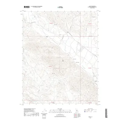
2018 Map of Jolon
USGS Topo · Published 2018About this map
The settlement of Jolon serves as the central hub of this Monterey County landscape, positioned at the junction of Jolon Rd and Mission Rd. The terrain is defined by the steep, deeply incised slopes of the Santa Lucia Range, where numerous named canyons such as Ruby Canyon, Lugo Canyon, and Nunez Canyon drain toward the valley floor. Water systems are prominent, with the San Antonio River flowing through the central plains and the Nacimiento River skirting the southern reaches near Los Bueyes Cr. This survey illustrates the intricate network of roads like Nacimiento-Fergusson Rd and Jolon Pleyto Rd that navigate the varied topography, connecting isolated canyon floors to the main thoroughfares. High points like Mesa Coyote offer a glimpse into the rugged interior of the range before it descends into the specialized drainages of Sam Jones Canyon and China Gulch.
Find a feature on this map
38 named features on this map. Tap any name to fly to it.
Don’t see what you’re looking for? This feature index may not catch every label — zoom into the map to look around manually.
Map Details
Editions of this 2018 Jolon Map
This is the sole edition of this map. No revisions or reprints were ever made.
Other maps of this area

1919 · King City
USGS Topo · 1:62,500

1919 · Junipero Serra
USGS Topo · 1:62,500

1919 · Bryson
USGS Topo · 1:62,500

1921 · Cape San Martin
USGS Topo · 1:62,500

1939 · King City
USGS Topo · 1:62,500

1941 · Cape San Martin
USGS Topo · 1:62,500

1941 · Junipero Serra
USGS Topo · 1:62,500

1941 · Bryson
USGS Topo · 1:62,500

1942 · Bryson
USGS Topo · 1:62,500

1942 · Cape San Martin
USGS Topo · 1:62,500