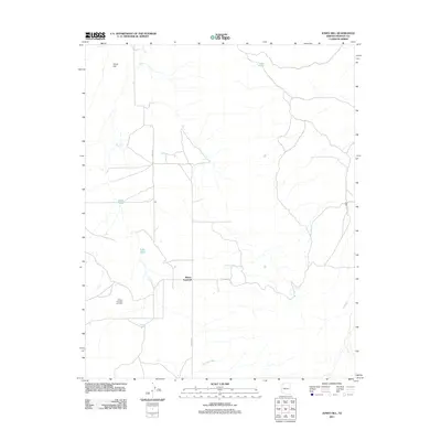
2011 Map of Jones Hill
USGS Topo · Published 2011About this map
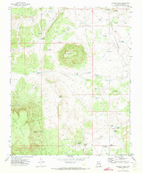
Mount Trumbull sits at the heart of this high-plateau landscape, where the distribution of water resources reflects the practical necessities of life in this arid Arizona region. The area is defined by a network of catchments and drainage features such as Bundy Tank, Cedar Pond, and the expansive Browns Reservoir. This 2011 survey highlights the remote settlement patterns of Mohave County, anchored by the Mount Trumbull Cemetery and served by rural transit routes like Co HWY 5 and Co HWY 257. Higher elevations are marked by Jones Hill in the northwest, while the lower terrain is carved by seasonal watercourses including Whitmore Wash and Langs Run. The map provides a clear view of the ranching-dependent infrastructure, with numerous small water points like Field Pond and Tony Pond scattered across the township lines.
Find a feature on this map
12 named features on this map. Tap any name to fly to it.
Don’t see what you’re looking for? This feature index may not catch every label — zoom into the map to look around manually.
Map Details
Editions of this 2011 Jones Hill Map
This is the sole edition of this map. No revisions or reprints were ever made.
Other maps of this area

1886 · Mt. Trumbull
USGS Topo · 1:250,000

1892 · Mt. Trumbull
USGS Topo · 1:250,000

1953 · Grand Canyon
USGS Topo · 1:250,000

1957 · Grand Canyon
USGS Topo · 1:250,000

1958 · Grand Canyon
USGS Topo · 1:250,000

1960 · Grand Canyon
USGS Topo · 1:250,000
1967 · Mt. Trumbull NW
USGS Topo · 1:24,000
1967 · Mount Logan
USGS Topo · 1:24,000
1971 · Moriah Knoll
USGS Topo · 1:24,000
1971 · Poverty Knoll
USGS Topo · 1:24,000