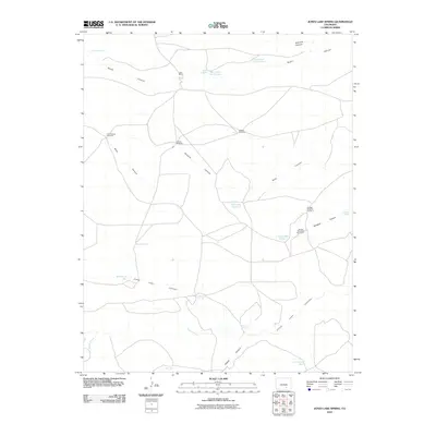
2010 Map of Jones Lake Spring
USGS Topo · Published 2010About this map
Harte Ranch sits at the northern end of this Las Animas County landscape, where the terrain is defined by a dense network of drainage systems and isolated water sources. The map documents a ranching environment where life and industry revolve around seasonal water, evidenced by the numerous wells and windmills scattered across the high plains. Vital water points such as Bushmire Well, Jolly Well, and Bull Pasture Well are strategically located near the deep cuts of South Canyon and Jones Lake Canyon.
Find a feature on this map
28 named features on this map. Tap any name to fly to it.
Don’t see what you’re looking for? This feature index may not catch every label — zoom into the map to look around manually.
Map Details
Editions of this 2010 Jones Lake Spring Map
This is the sole edition of this map. No revisions or reprints were ever made.
Other maps of this area

1891 · Apishapa
USGS Topo · 1:125,000

1893 · Apishapa
USGS Topo · 1:125,000

1897 · Apishapa
USGS Topo · 1:125,000

1954 · Trinidad
USGS Topo · 1:250,000

1955 · Trinidad
USGS Topo · 1:250,000

1958 · Trinidad
USGS Topo · 1:250,000

1959 · Trinidad
USGS Topo · 1:250,000
1970 · Myers Canyon
USGS Topo · 1:24,000
1970 · Sanford Hills
USGS Topo · 1:24,000
1971 · South Rattlesnake Butte
USGS Topo · 1:24,000