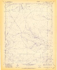
1971 Map of South Rattlesnake Butte
USGS Topo · Published 1973About this map
The arid ranching landscape of the Colorado high plains is defined here by the drainage network of South Rattlesnake Canyon and Dripping Springs Canyon. This 1971 survey captures a remote section of the Huerfano Co Las Animas Co border, where water is the most critical resource for the scattered homesteads. The distribution of windmills such as the Cordova Windmill and Sanchez Windmill indicates a landscape primarily utilized for livestock grazing. The presence of the South Butte School near South Butte suggests a once-active rural community hub, while Summer Camp in the north and various water tanks across the plains mark the infrastructure of the early 1970s cattle industry. Topographic details highlight the transition from flat grasslands to the deep, winding cuts of Jones Lake Canyon.
Find a feature on this map
23 named features on this map. Tap any name to fly to it.
Don’t see what you’re looking for? This feature index may not catch every label — zoom into the map to look around manually.
Map Details
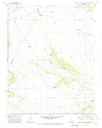
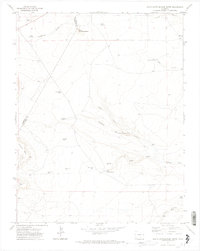
Editions of this 1971 South Rattlesnake Butte Map
3 editions found
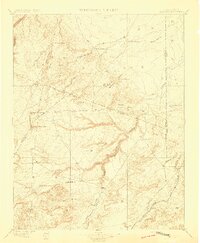
Other maps of this area

1891 · Walsenburg
USGS Topo · 1:125,000

1891 · Apishapa
USGS Topo · 1:125,000

1893 · Apishapa
USGS Topo · 1:125,000

1894 · Walsenburg
USGS Topo · 1:125,000

1897 · Walsenburg
USGS Topo · 1:125,000
1897 · Apishapa
USGS Topo · 1:125,000

1900 · Walsenburg
USGS Topo · 1:125,000

1954 · Trinidad
USGS Topo · 1:250,000

1955 · Trinidad
USGS Topo · 1:250,000

1958 · Trinidad
USGS Topo · 1:250,000