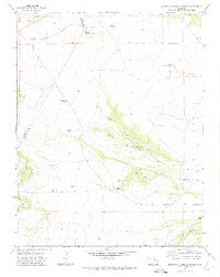
1971 Map of South Rattlesnake Butte
USGS Topo · Published 1974About this map
South Rattlesnake Butte dominates the northern horizon of this landscape along the Huerfano and Las Animas county line. In the early 1970s, this area remained a sparsely populated rangeland characterized by deep drainage systems like Romer Canyon and Jones Lake Canyon. The presence of the South Butte School indicates a decentralized community of ranching families who relied on a network of water improvements for their livestock. Windmills and water tanks are the primary signs of human infrastructure, including the Sanchez Windmill, Cordova Windmill, and West Donner Windmill. Notable natural water sources such as Big Dripping Spring and Arroyo Spring puncture the arid terrain, while Summer Camp sits at the edge of the northern canyons near Baker Reservoir.
Find a feature on this map
25 named features on this map. Tap any name to fly to it.
Don’t see what you’re looking for? This feature index may not catch every label — zoom into the map to look around manually.
Map Details
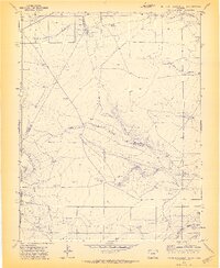
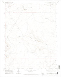
Editions of this 1971 South Rattlesnake Butte Map
3 editions found
Other maps of this area

1891 · Walsenburg
USGS Topo · 1:125,000

1891 · Apishapa
USGS Topo · 1:125,000

1893 · Apishapa
USGS Topo · 1:125,000

1894 · Walsenburg
USGS Topo · 1:125,000

1897 · Walsenburg
USGS Topo · 1:125,000

1897 · Apishapa
USGS Topo · 1:125,000

1900 · Walsenburg
USGS Topo · 1:125,000

1954 · Trinidad
USGS Topo · 1:250,000

1955 · Trinidad
USGS Topo · 1:250,000

1958 · Trinidad
USGS Topo · 1:250,000