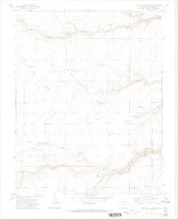
1971 Map of Jones Lake Spring
USGS Topo · Published 1974About this map
Harte Ranch and several family-named wells define the ranching landscape of this high plains region in the early 1970s. The terrain is characterized by a network of deep-cut drainages including South Canyon, Bass Canyon, and Jones Lake Canyon, which feed into the central Jones Lake basin. This survey documents the critical water infrastructure required for livestock in this arid environment, specifically identifying the East Downer Windmill, Patches Windmill, and McGee Windmill.
Find a feature on this map
41 named features on this map. Tap any name to fly to it.
Don’t see what you’re looking for? This feature index may not catch every label — zoom into the map to look around manually.
Map Details
Editions of this 1971 Jones Lake Spring Map
This is the sole edition of this map. No revisions or reprints were ever made.
Other maps of this area

1891 · Apishapa
USGS Topo · 1:125,000

1893 · Apishapa
USGS Topo · 1:125,000

1897 · Apishapa
USGS Topo · 1:125,000

1954 · Trinidad
USGS Topo · 1:250,000

1955 · Trinidad
USGS Topo · 1:250,000

1958 · Trinidad
USGS Topo · 1:250,000

1959 · Trinidad
USGS Topo · 1:250,000
1970 · Myers Canyon
USGS Topo · 1:24,000
1970 · Sanford Hills
USGS Topo · 1:24,000
1971 · South Rattlesnake Butte
USGS Topo · 1:24,000