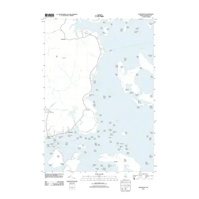
2011 Map of Jonesport
USGS Topo · Published 2011About this map
The coastal village of Jonesport and the island community of Beals anchor this 2011 survey of the Downeast shoreline. Separated by the waters of Moosabec Reach, these settlements are defined by their deep connection to the Atlantic, with local infrastructure such as the Beals Island Bridge and Mill Pond Rd providing essential links between the mainland and the nearby islands. The landscape is a complex archipelago including Roque Island, Great Spruce Island, and Pond Cove Island, marking the entrance to Englishman Bay and Chandler Bay.
Find a feature on this map
128 named features on this map. Tap any name to fly to it.
Don’t see what you’re looking for? This feature index may not catch every label — zoom into the map to look around manually.
Map Details
Editions of this 2011 Jonesport Map
This is the sole edition of this map. No revisions or reprints were ever made.
Other maps of this area

1918 · Machias
USGS Topo · 1:62,500

1921 · Great Wass Island
USGS Topo · 1:62,500

1921 · Columbia Falls
USGS Topo · 1:62,500

1921 · Columbia Falls
USGS Topo · 1:62,500

1941 · Columbia Falls
USGS Topo · 1:62,500

1941 · Machias
USGS Topo · 1:62,500

1942 · Columbia Falls
USGS Topo · 1:62,500

1948 · Jonesport
USGS Topo · 1:24,000
1948 · Columbia Falls
USGS Topo · 1:24,000

1948 · Roque Bluffs
USGS Topo · 1:24,000