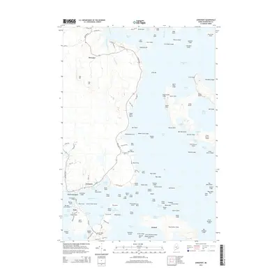
2014 Map of Jonesport
USGS Topo · Published 2014About this map
Monsapec and West Jonesport anchor this coastal Maine landscape, where the sea deeply penetrates the land through complex tidal networks like Mason Bay and Chandler Bay. The settlement patterns here are defined by the water, with the town of Beals positioned across Moosabec Reach, connected to the mainland by the Beals Island Bridge. This maritime economy is evident in the numerous small coves and harbors, including Sawyer Cove and Beals Harbor, which have long served the local fishing and seafaring communities.
Find a feature on this map
156 named features on this map. Tap any name to fly to it.
Don’t see what you’re looking for? This feature index may not catch every label — zoom into the map to look around manually.
Map Details
Editions of this 2014 Jonesport Map
This is the sole edition of this map. No revisions or reprints were ever made.
Other maps of this area

1918 · Machias
USGS Topo · 1:62,500

1921 · Great Wass Island
USGS Topo · 1:62,500

1921 · Columbia Falls
USGS Topo · 1:62,500

1921 · Columbia Falls
USGS Topo · 1:62,500

1941 · Columbia Falls
USGS Topo · 1:62,500

1941 · Machias
USGS Topo · 1:62,500

1942 · Columbia Falls
USGS Topo · 1:62,500

1948 · Jonesport
USGS Topo · 1:24,000
1948 · Columbia Falls
USGS Topo · 1:24,000

1948 · Roque Bluffs
USGS Topo · 1:24,000