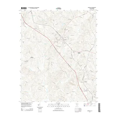
2014 Map of Jonesville
USGS Topo · Published 2014About this map
Jonesville serves as the primary hub of this northern Union County landscape, where the Furman L Fendley Hwy intersects with a network of local roads including N Main St and Harris St. The area's agricultural and rural heritage is evident in the numerous family and community burial grounds, such as Weber-Haile Cem, Gilead Cem, and the Mitchell Cem near Jumping Run Cr.
Find a feature on this map
109 named features on this map. Tap any name to fly to it.
Don’t see what you’re looking for? This feature index may not catch every label — zoom into the map to look around manually.
Map Details
Editions of this 2014 Jonesville Map
This is the sole edition of this map. No revisions or reprints were ever made.
Other maps of this area

1941 · Spartanburg
USGS Topo · 1:250,000

1947 · Spartanburg
USGS Topo · 1:62,500

1949 · Spartanburg
USGS Topo · 1:62,500

1953 · Spartanburg
USGS Topo · 1:250,000

1960 · Spartanburg
USGS Topo · 1:250,000

1963 · Spartanburg
USGS Topo · 1:250,000

1964 · Spartanburg
USGS Topo · 1:250,000
1968 · Wilkinsville
USGS Topo · 1:24,000

1969 · Cross Anchor
USGS Topo · 1:24,000
1969 · Pacolet Mills
USGS Topo · 1:24,000