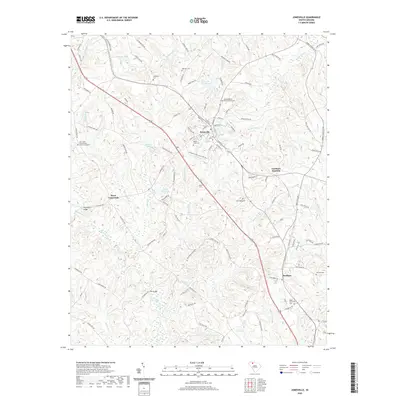
2020 Map of Jonesville
USGS Topo · Published 2020About this map
Jonesville serves as the central hub of this South Carolina landscape, where the intersection of local industry and deep-rooted community history is clearly visible. The town's layout is marked by the Weber-Haile Cem and the Jonesville Industrial Park Rd, reflecting a lineage that stretches from early family plots to modern economic development. To the north, the Gilead Baptist Church Graveyard stands as a significant genealogical landmark, while the surrounding rural territory is defined by a dense network of family-named roads such as Jeffries Farm Rd and Robinson Farm Rd.
Find a feature on this map
110 named features on this map. Tap any name to fly to it.
Don’t see what you’re looking for? This feature index may not catch every label — zoom into the map to look around manually.
Map Details
Editions of this 2020 Jonesville Map
This is the sole edition of this map. No revisions or reprints were ever made.
Other maps of this area

1941 · Spartanburg
USGS Topo · 1:250,000

1947 · Spartanburg
USGS Topo · 1:62,500

1949 · Spartanburg
USGS Topo · 1:62,500

1953 · Spartanburg
USGS Topo · 1:250,000

1960 · Spartanburg
USGS Topo · 1:250,000

1963 · Spartanburg
USGS Topo · 1:250,000

1964 · Spartanburg
USGS Topo · 1:250,000
1968 · Wilkinsville
USGS Topo · 1:24,000

1969 · Cross Anchor
USGS Topo · 1:24,000
1969 · Pacolet Mills
USGS Topo · 1:24,000