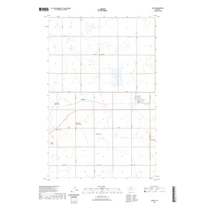
2020 Map of Joplin
USGS Topo · Published 2020About this map
Joplin serves as the primary hub on this High Line landscape, where the grid of the northern Montana plains meets the intricate drainage systems of the local coulees. The town's layout is clearly defined by its residential streets like Rehal Ave and Norman Ave, situated just north of the Joplin Cem. To the west, the smaller settlement of Buelow sits at the intersection of Bison Rd and the east-west highway, marking a distinct point in the agricultural expanse. The surrounding terrain is characterized by the broad, level surface of Rehal Flat and several deeply etched seasonal waterways, including East Branch Alma Coulee and Bison Coulee. This survey captures the region's methodical section-line road system and the infrastructure, such as the prominent Power Line Rd, that supports this remote corner of Liberty County.
Find a feature on this map
32 named features on this map. Tap any name to fly to it.
Don’t see what you’re looking for? This feature index may not catch every label — zoom into the map to look around manually.
Map Details
Editions of this 2020 Joplin Map
This is the sole edition of this map. No revisions or reprints were ever made.
Other maps of this area

1919 · Alma
USGS Topo · 1:125,000

1954 · Shelby
USGS Topo · 1:250,000

1958 · Shelby
USGS Topo · 1:250,000

1963 · Joplin
USGS Topo · 1:24,000

1963 · Chester NW
USGS Topo · 1:24,000

1963 · Chester NE
USGS Topo · 1:24,000

1963 · Chester
USGS Topo · 1:24,000

1970 · Poverty Coulee NE
USGS Topo · 1:24,000

1970 · Rocky Coulee
USGS Topo · 1:24,000

1970 · Poverty Coulee
USGS Topo · 1:24,000