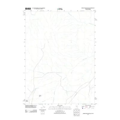
2011 Map of Jordan Meadow NW
USGS Topo · Published 2011About this map
Jordan Meadow Flat and the surrounding high desert terrain dominate this 2011 landscape along the Oregon-Nevada border. This area is defined by a complex drainage network, where McDermitt Creek flows through the northern reaches while Washburn Creek and its tributary, Little Washburn Creek, carve through the central and southern sections. The map reveals a land utilized for remote transit and ranching, anchored by the namesake Jordan Meadow Mountain in the southwest. Human activity is sparse, marked primarily by the Jordan Meadow Rd which provides access through the eastern corridor. The convergence of numerous seasonal waterways, including Wildcat Creek and Jordan Meadow Creek, highlights the hydrological significance of these flats for local land use and ecological patterns in Malheur County.
Find a feature on this map
9 named features on this map. Tap any name to fly to it.
Don’t see what you’re looking for? This feature index may not catch every label — zoom into the map to look around manually.
Map Details
Editions of this 2011 Jordan Meadow NW Map
This is the sole edition of this map. No revisions or reprints were ever made.
Other maps of this area

1882 · Paradise
USGS Topo · 1:250,000

1886 · Disaster
USGS Topo · 1:250,000

1893 · Paradise
USGS Topo · 1:250,000

1893 · Disaster
USGS Topo · 1:250,000

1954 · Vya
USGS Topo · 1:250,000

1955 · McDermitt
USGS Topo · 1:250,000

1955 · Jordan Valley
USGS Topo · 1:250,000

1955 · Adel
USGS Topo · 1:250,000

1957 · Adel
USGS Topo · 1:250,000

1957 · Jordan Valley
USGS Topo · 1:250,000