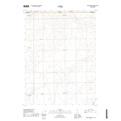
2018 Map of Jordan Meadow NW
USGS Topo · Published 2018About this map
The high desert borderland where Oregon and Nevada meet is defined by a network of seasonal drainages and topographic ridges. Much of the southern portion of this landscape is occupied by the expansive Jordan Meadow Flat, a prominent basin floor positioned below the Sentinel Hills. This 2018 survey illustrates how the drainage patterns of the Great Basin dictate the geography, with McDermitt Cr and Washburn Cr carving through the terrain. The presence of Long Ridge provides a significant vertical break in the landscape, separating the various branches of Little Washburn Cr and Wildcat Cr. For those studying the remote border regions of Malheur and Humboldt counties, this map provides the exact placement of these watercourses and landforms as they existed in the early 21st century.
Find a feature on this map
20 named features on this map. Tap any name to fly to it.
Don’t see what you’re looking for? This feature index may not catch every label — zoom into the map to look around manually.
Map Details
Editions of this 2018 Jordan Meadow NW Map
This is the sole edition of this map. No revisions or reprints were ever made.
Other maps of this area

1882 · Paradise
USGS Topo · 1:250,000

1886 · Disaster
USGS Topo · 1:250,000

1893 · Paradise
USGS Topo · 1:250,000

1893 · Disaster
USGS Topo · 1:250,000

1954 · Vya
USGS Topo · 1:250,000

1955 · McDermitt
USGS Topo · 1:250,000

1955 · Jordan Valley
USGS Topo · 1:250,000

1955 · Adel
USGS Topo · 1:250,000

1957 · Adel
USGS Topo · 1:250,000

1957 · Jordan Valley
USGS Topo · 1:250,000