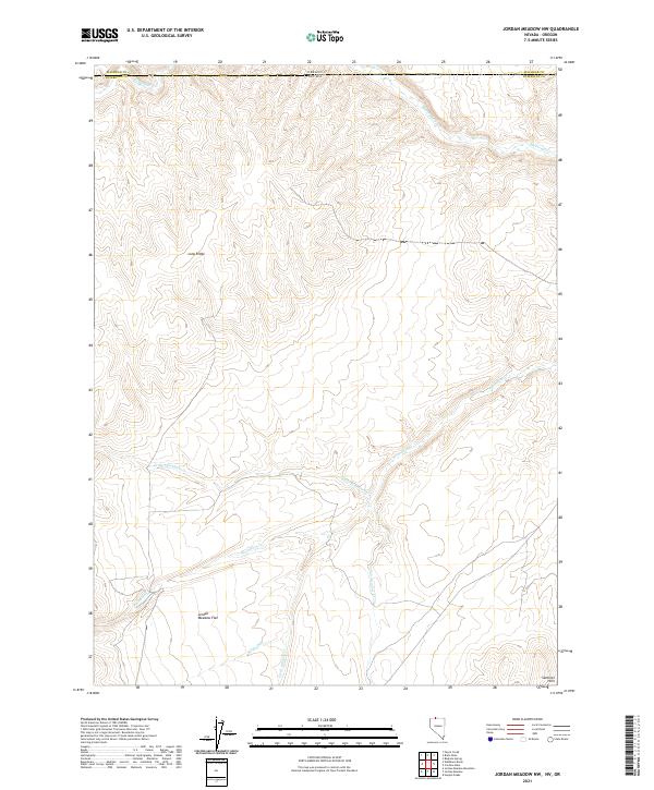
2021 Map of Jordan Meadow NW
USGS Topo · Published 2021About this map
Jordan Meadow Flat defines the southwestern portion of this high-desert landscape on the border of Nevada and Oregon. This modern topographic study shows a complex network of drainage basins, with several seasonal streams flowing from the surrounding high ground toward the central meadow. The prominent Long Ridge runs through the northwestern quadrant, while the Sentinel Hills rise in the southeast, framing the local hydrology.
Find a feature on this map
11 named features on this map. Tap any name to fly to it.
Don’t see what you’re looking for? This feature index may not catch every label — zoom into the map to look around manually.
Map Details
Editions of this 2021 Jordan Meadow NW Map
This is the sole edition of this map. No revisions or reprints were ever made.
Other maps of this area

1882 · Paradise
USGS Topo · 1:250,000

1886 · Disaster
USGS Topo · 1:250,000

1893 · Paradise
USGS Topo · 1:250,000

1893 · Disaster
USGS Topo · 1:250,000

1954 · Vya
USGS Topo · 1:250,000

1955 · McDermitt
USGS Topo · 1:250,000

1955 · Jordan Valley
USGS Topo · 1:250,000

1955 · Adel
USGS Topo · 1:250,000

1957 · Adel
USGS Topo · 1:250,000

1957 · Jordan Valley
USGS Topo · 1:250,000