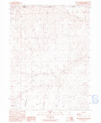
1991 Map of Jordan Meadow NW
USGS Topo · Published 1991About this map
McDermitt Creek flows through the high desert of the Great Basin along the border of Nevada and Oregon, defining the remote character of this landscape in the early 1990s. The terrain is dominated by the prominent Long Ridge and Jordan Meadow Mountain, providing a clear view of the complex drainages of Washburn Creek and its tributaries. While primarily an open grazing and natural area, several Prospect labels and Prospects denote a history of mineral exploration in the hills. The presence of numerous Stock Pond and Stock Ponds locations, along with natural Spring and Springs sites, reveals the essential water infrastructure required for livestock in this arid environment. The map captures the geography of the Jordan Meadow Flat before modern changes, preserving the intricate drainage patterns of Little Wildcat Cr and Jordan Meadow Creek as they existed during this field check era.
Find a feature on this map
17 named features on this map. Tap any name to fly to it.
Don’t see what you’re looking for? This feature index may not catch every label — zoom into the map to look around manually.
Map Details
Editions of this 1991 Jordan Meadow NW Map
This is the sole edition of this map. No revisions or reprints were ever made.
Other maps of this area

1882 · Paradise
USGS Topo · 1:250,000

1886 · Disaster
USGS Topo · 1:250,000

1893 · Paradise
USGS Topo · 1:250,000

1893 · Disaster
USGS Topo · 1:250,000

1954 · Vya
USGS Topo · 1:250,000

1955 · McDermitt
USGS Topo · 1:250,000

1955 · Jordan Valley
USGS Topo · 1:250,000

1955 · Adel
USGS Topo · 1:250,000

1957 · Adel
USGS Topo · 1:250,000

1957 · Jordan Valley
USGS Topo · 1:250,000